Advertisement
First Snowstorm Of 2014 Moves Into Mass.
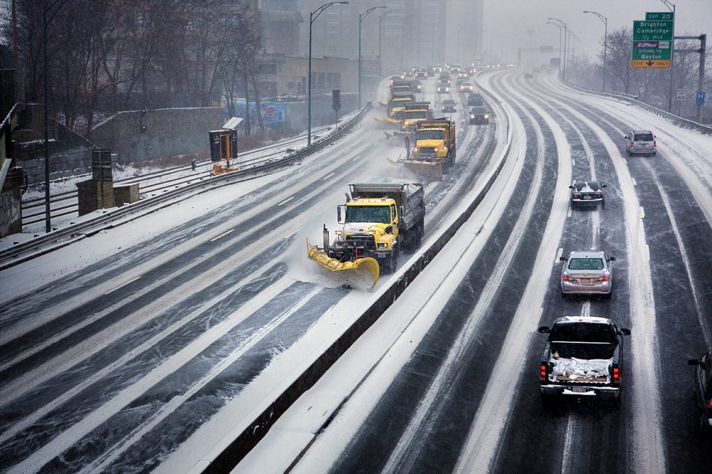
BOSTON — The first winter storm of 2014 moved into eastern Massachusetts Thursday, bringing with it a forecast of some blizzard conditions, high winds and coastal flooding.
Meteorologist David Epstein predicts most of Greater Boston will see at least a foot of snow, with smaller accumulations on Cape Cod and the Islands and moving west across the state.

The brunt of the storm is expected to hit Thursday evening into Friday morning, when snowfall rates will likely reach 1 to 2 inches per hour. The heavy snow and gusty winds could create blizzard conditions along coastal Plymouth County and Cape Cod, making overnight travel nearly impossible along the immediate coastline.
The storm has the potential to cause minor to moderate flooding along the coast. Early Thursday, Massachusetts Emergency Management Agency spokesman Peter Judge said state officials are most concerned about high tide Thursday night and Friday afternoon.
"If you live anywhere along the coast it's something you really want to be aware of and you want to listen to your public safety officials," Judge said. "If they make any recommendations for actions for you to take, to respond very quickly."
Utilities said Thursday afternoon that the combination of high snow volume and strong winds is likely to result in some power disruptions.
State public works Commissioner David Cash said the utilities appear ready for the storm.
"But we have been very clear, and I think the utilities well understand, that it's the execution on [emergency response] plans and restoring service if and when it goes down that they need to be responsive to," Cash told WBUR.
Cold temperatures will be a serious concern throughout the storm and into the weekend, when wind chills could drop well below zero.
"We're going to have wind chills ... 10 to 20 below [Friday] morning, actual temperatures in the single digits," meteorologist Epstein said. "And Saturday morning many places will go several degrees below zero."
Gov. Deval Patrick warned of the cold conditions in a Thursday afternoon news conference.
The state Department of Transportation said about 1,500 pieces of snow clearing equipment were on the roads Thursday, and Massachusetts State Police lowered the speed limit on the entire Mass Pike to 40 miles per hour.
Patrick sent Massachusetts state workers home at 3 p.m. and encouraged private employers to send their workers home too. He also authorized the National Guard to help out if needed.
Massport Aviation Director Ed Freni said Logan Airport would remain open through the storm but the last scheduled departure is expected at around 8:30 p.m. Thursday. He predicted operations would not resume until around noon Friday. Freni encouraged travelers to check with their airline before heading to the airport.
Dozens of school districts were closed Thursday, and others, including Boston, already cancelled classes for Friday. Many communities also issued snow emergency parking bans.
With additional reporting by The Associated Press
This article was originally published on January 02, 2014.