Advertisement
Weather Watchers On Blue Hills Await Record-Breaking Final Inch Of Snow
Resume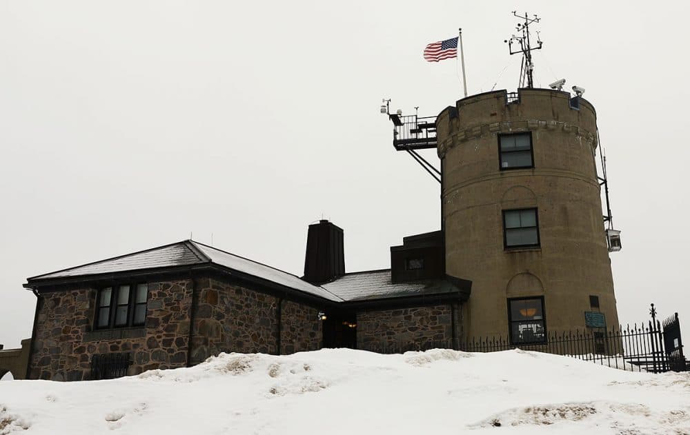
Some 635 feet above sea level, at the Blue Hill Observatory & Science Center, Brian Fitzgerald climbs to the top of the building's tower. It’s a castle-like structure he calls a weather geek’s paradise: a tangle of meteorological widgets and whirling doodads he visits three times a day.
This winter has been special for Fitzgerald, chief observer at the center, with all matter of records being broken save the one that seems to matter most: snowiest recorded winter of all time.
"I've had a lot of people all around me say, 'You're living through history right now,' which is kind of a funny sentiment," Fitzgerald says. "But it makes you really think about what you're recording now, how you're going to look back at something like this. Is this the new normal? Will we ever see this again?”
He adds: “I'm thinking long and hard about all the things I want to write down and record for history."
The storm making its way east this weekend has observers at the center — the nation's oldest operating weather observatory — keeping close tabs. But it looks like the Blue Hills will only get more rain than snow.
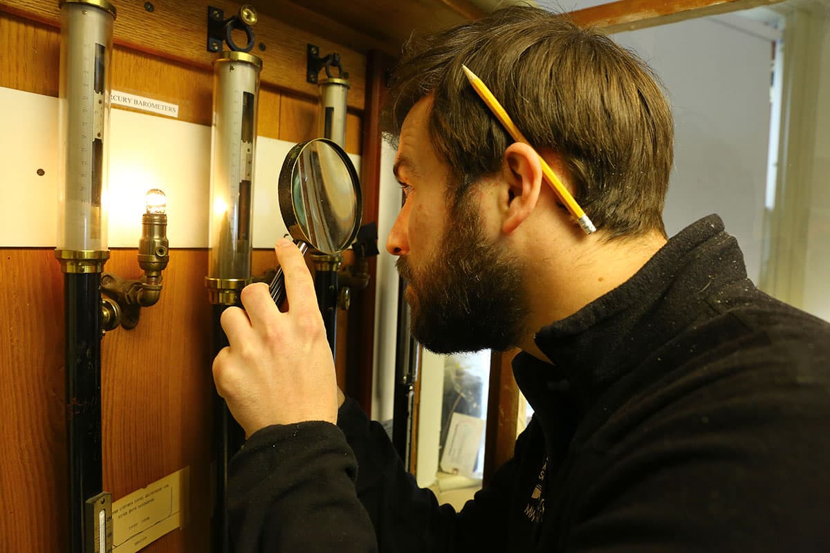
People like Fitzgerald have collected data uninterrupted since 1885, using in many cases the same instruments used 130 years ago. These days it’s the snow tracking devices drawing the most attention. As of Friday, 143.4 inches had fallen, exactly 1 inch shy of the snowiest winter on record.
Fitzgerald says he’ll be disappointed if it doesn't happen. But for some researcher somewhere down the line, all the numbers he's collecting will be a looking glass into the winter of 2015.
Climatologists say warmer ocean temperatures off the Atlantic Coast are to blame for greater-than-normal accumulations of moisture in the atmosphere. On top of that, heavy Arctic winds have led to colder temperatures, which mean fluffier snow.
It's tempting to jump to conclusions about climate change every time there's a major weather event. But those keeping daily measurements tend toward caution.
Kerry Emanuel, who teaches atmospheric science at MIT and sits on the observatory's board, cautions against reading too much into extremes like this winter. The data simply doesn’t go back far enough.
"We don't have too many snow seasons, even going back 150 years, like we had this year,” Emanuel says. “So what are we to make of the fact that we've had one? Maybe we've seen a 1-in-200-year event. Maybe we've seen a 1-in-50-year event under a different climate. But there's no way for us to tell the difference from just the observation."
Instead of grand proclamations, Emanuel extols the daily minutia of data collection, which over time can tell us about larger climate trends.
One dataset kept at Blue Hill is snow-to-water ratio, or fluffiness. At the observatory, this winter’s snow is 35 percent fluffier than normal, which results in greater accumulation.
This is tracked by catching snow in metal buckets, then measuring the water as it melts out. It’s a primitive technique, but it’s part of what makes the records so valuable. Michael Iacono, a climatologist at the observatory, says they observe the weather the way it was done a century ago for the sake of consistency.
Blue Hill measures humidity using real human hair — and, for consistency, hair of strictly Scandinavian descent.
Iacono and his team recently released a paper documenting long term sunshine trends using a glass sphere, the Campbell–Stokes sunshine recorder. The glass ball magnifies light onto a strip of paper, branding a timestamp the same way it’s been done since 1889.
Iacono says temps recorded at the observatory have increased by 3 degrees Fahrenheit since the 19th century. A less-known fact is that the wind has slowed down. Over the last three decades, average annual wind speeds have fallen from 15 to 13 miles an hour. That could be a clue about this winter’s storms.
"It did contribute somewhat to this season, yes," Iacono says. "There were a few storms that were somewhat slower and lasted longer."
But they didn’t last long enough to break the record — at least not yet.
“One storm, that’s all we need, just one even brief shower that lasts long enough to give us that 1.1 inches, then we can just be done with it,” says Fitzgerald, the Blue Hill chief observer. “I feel like it’d almost be all for naught if it didn’t happen.”