Advertisement
Forecast: Snow Will End This Evening, Temps Remain Cold
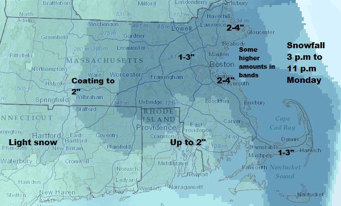
Update 3:20 p.m.
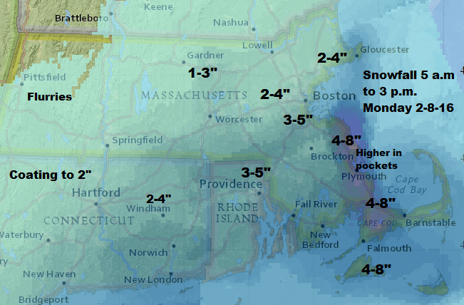
Wild for a time, but mild overall — that's what many of you might be thinking this evening as the storm winds down. The map below shows how much snow I expect will fall from mid-afternoon through the final flakes from this storm later this evening.
There was minor to moderate flooding along the coast this morning during high tide. The good news is tonight's high tide will be lower and any flooding will be minor.
Temperatures remain in the teens and lower 20s, so bundle up as you clean up. Tomorrow still looks like a few snow showers, but not a second storm.
Our original post continues:
After a very nice Sunday across the region we find winter storm warnings and even a blizzard warning posted for southern New England today.
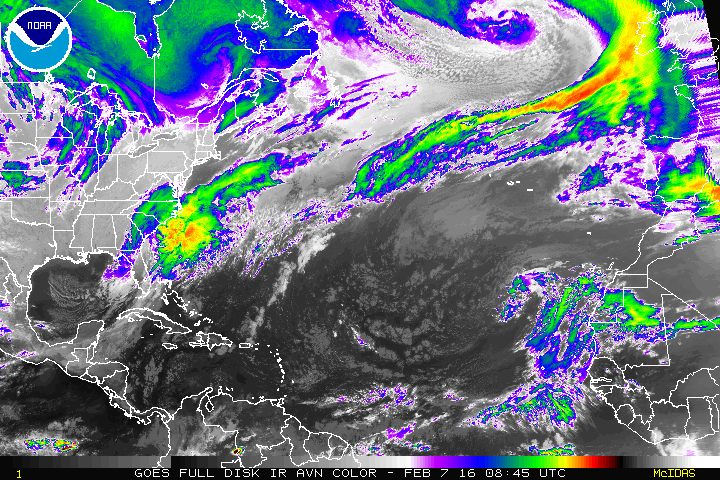
The storm bringing this weather is currently located more than 500 miles from Boston. A storm that far way won’t bring its full impact, however, the western edge of the storm is close enough to provide the region with strong winds and snow.
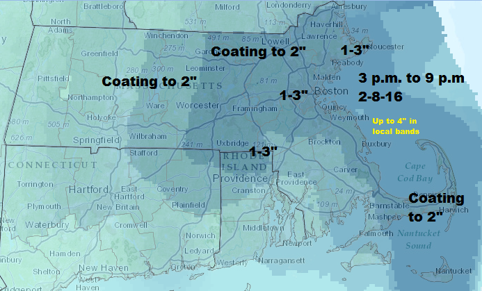
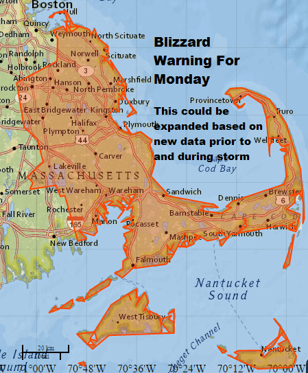
A blizzard warning has been posted for the South Shore, Cape Cod and the Islands as the combination of wind and snow will make for low visibility. Once the snow begins, travel in these areas will be difficult.
Don't worry — this won't be a blockbuster snow event. As a matter of fact, many areas may not surpass the snow totals they saw Friday. However, the timing of the storm and the fact the warnings are issued have resulted in lots of cancellations.
The maps below show how much snow I expect in the area throughout today and through the first part of the overnight. I broke the maps up into time blocks to make it easier to plan. The heaviest part of the storm will be from about 11 a.m until roughly 6 p.m.
Power outages can always occur when winds become this strong, especially at the coastline. While the snow may start wet, it will actually trend less heavy during the day as colder air works into the region.
After dark there will be some lighter snow showers, and these can linger into Tuesday. Roads could become slick along the coastline as some ocean effect bands of snow develop later Tuesday, but this won’t be a big issue.
The coldest air of the season arrives this weekend and lasts for a few days. I don’t see this being prolonged or record shattering, although Boston could come close on Valentine’s Day morning when the record low is 3 below zero.
You can follow my weather updates on Twitter at @growingwisdom.
Today: Snow developing, windy and turning colder. Temperatures falling to the mid 20s by sunset.
Tonight: Snow ending, still windy and cold. Lows in the 20s.
Tuesday: A few snow showers. Some light accumulation possible. Highs 30-35.
Wednesday: A chance of snow showers. High near 35.
Thursday: Lots of clouds, a snow shower or squall. Turning cold late. Highs 25-34.
Friday: Mostly sunny, with a high near 25.
