Advertisement
Forecast: After A Sunny Day, Some Wintry Weather For Thanksgiving
The day before Thanksgiving is a big travel day, and if you plan to be driving this afternoon it's time to pack your patience. The good news is the weather will cooperate with dry roads and clear skies. Remember the sun's angle is very low this time of year. If you are headed south or west this afternoon, expect lots of solar glare, so don't forget the sunglasses. Traffic can actually be slowed significantly as drivers have trouble seeing through the setting sun.
Our next weather trouble arrives early tomorrow. A very weak weather weather system moves east from the Ohio Valley and brings some light precipitation. You might have forgotten, but it takes very little frozen precipitation to create big problems on the roads. I am not forecasting big issues, but only reminding you about the hazards of winter driving.
Thursday morning much of the area will see some light freezing drizzle, snow or just plain drizzle or light rain. There will be nothing more than a coating, but roads may be cold enough for icy spots. Secondary roads often have problems in these situations when other roads are fine.
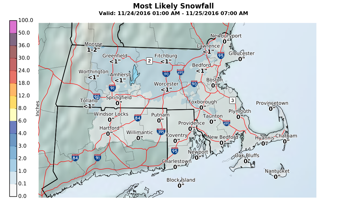
The most likely places to see any wintry weather will be west of Route 495. East of there it looks to be too warm for any issues.
Since this is such a small event, it may even be less of problem that forecast. I will give updates as things change later today on Twitter.
You can follow my weather updates on Twitter at @growingwisdom.
Wednesday: Mostly sunny, less wind. Highs in the lower 40s.
Wednesday Night: Mainly clear early, clouds by morning. Lows 28-33
Thursday (Thanksgiving): Some light freezing drizzle or snow, especially in the morning west of Route 495. Liquid precipitation east of that area including Boston. Highs in the 30s. Watch for slick spots if traveling north. A coating in most areas that see any snow.
Friday: Cloudy, a few showers. Highs in the mid 40s.
Saturday: A period of rain in the morning, then cloudy. Highs in the upper 40s.
Sunday: Partly to mostly cloudy, could shower early, highs in the mid to upper 40s.
Monday: Sunny with highs in the mid to upper 40s.
