Advertisement
Forecast: Today's Cold Weather Won't Last, January Thaw Ahead
It is cold this morning. It feels and looks like winter. Temperatures are in the single numbers to low teens. It feels below zero in many areas, and there is snow cover across the entire region.
Thus far, in the meteorological winter of 2016-17 — which runs from December to February — weather conditions have been just about average in terms of both temperature and snowfall.
January Thaw
The weather is about to undergo a big change for the rest of the workweek. We have a January thaw on the way. This thaw will turn the landscape back into a brown and gray one, leaving only the largest snow piles along the road and in the parking lots.
This thaw won't be record-breaking, but it will bring temperatures in the 50s through the afternoon Friday, keeping highs above the melting point through the evening. This means many hours ahead of slow and sometimes not-so-slow melting. The ground is frozen and a lot of the water will just run off and never make it into the groundwater.
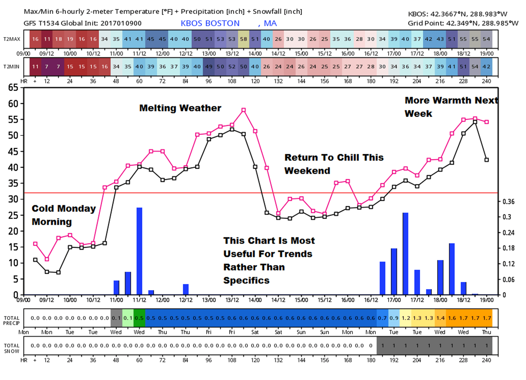
A return to more seasonable weather takes place over the weekend with subfreezing air back in the picture. However, as I look at the models beyond this weekend, both the American and Euro models see another warm push of air. The chart below is from the GFS or American Model.
This chart is most useful for trends rather than specifics, and the trend shows two peaks of warmth in the coming 10 days. Let's see how it does.
Look for updates here and on Twitter @growingwisdom.
Monday: Sunny and cold. 19-24 in the afternoon. Winds will be brisk and wind chill low.
Monday Night: Partly Cloudy and still cold, less wind. Lows 10-17.
Tuesday: Lots of clouds, then a chance of a showers late in the day. Not so cold. Highs 35-40.
Wednesday: Any showers end early then clearing. Highs near 50.
Thursday: Partly to mostly cloudy 50-55
Friday: Sun and clouds, highs around 50.
