Advertisement
Forecast: January Thaw Begins Today, With Warmer Days Expected Over Next 2 Weeks
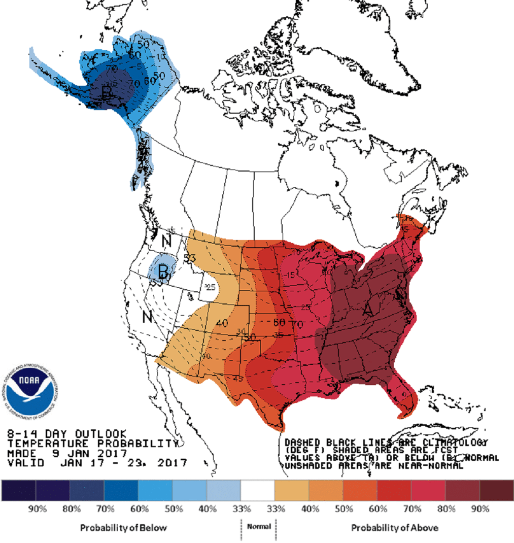
It's been a cold few days with temperatures near 0 degrees during the morning and remaining below freezing throughout the day. This pattern is about to undergo a big shift, and I am thinking it's two weeks of above-average temperatures ahead.
This of course means a loss of snow cover, melting pond ice and the feeling of spring in the middle of winter. A few days of warmth in January is actually not uncommon. January thaws are the stuff of New England weather folklore. However, a 14-day stretch with little cold in between is certainly less common and will definitely be a reminder of a changing climate, even if this particular weather event isn't related to an overall shifting pattern.
As the warm air arrives later today, there could be a bit of snow or mixed precipitation. This will bring a coating at most and is not something of great concern. There could be some black ice with the precipitation as the road surfaces stay below freezing for some time after the temperature of the air has gone into the melting range.
Tomorrow starts with some rain with temperatures rising into the lower and even middle 40s by the time you are off to work or school. The warmth grows during the day as highs reach 50 degrees. Temperatures remain 10-20 degrees above average Thursday and Thursday night, bringing along a few showers, too.
Temperatures won't fall under the 32-degree mark until later on Friday. Although the average temperature will exceed 30-year normals over the next two weeks, there still can be two or three days of cold. This weekend, Saturday's highs again stay in the upper 20s, and as more warm air tries to move north late in the weekend, there might be more mixed precipitation.
Look for updates here and on Twitter @growingwisdom.
Tuesday: Lots of clouds, then a chance of a showers or perhaps some spotty, mixed precipitation late in the day. Not so cold. Highs 35-40.
Tuesday Night: Cloudy and becoming breezing and milder. A few showers as temperatures rise into the 40s.
Wednesday: Any showers end early before clearing skies. Highs near 50.
Thursday: Partly to mostly cloudy. There is a risk of a few showers. Highs 50-55.
Friday: Sun and clouds. Highs in the morning in the upper 40s, but falling during the day to below freezing.
Saturday: Partly cloudy, some flurries. Highs 27-33.
