Advertisement
Forecast: Chilly, Breezy Weekend Ahead; Snowstorm Possible Next Week
As we head into the weekend, breezy conditions with below normal temperatures will make it feel very much like winter.
It will be quite cloudy Sunday. However, the weekend will stay mainly dry, and those with outdoor plans can bank on keeping them.
The next weather-maker will be a storm that develops to our west Tuesday. With cold air in place, there is likely to be some snow at the start, but precipitation eventually will change to rain.
The wet weather will last into Wednesday, but cold air from Canada will likely quickly follow the precipitation next Thursday and Friday.
This week will mark the 39th anniversary of the "Blizzard of '78" when Boston received what was then a record of 27.1 inches of snow. Many coastal locations reported winds above hurricane strength, with Chatham’s peak gust topping 93 mph.
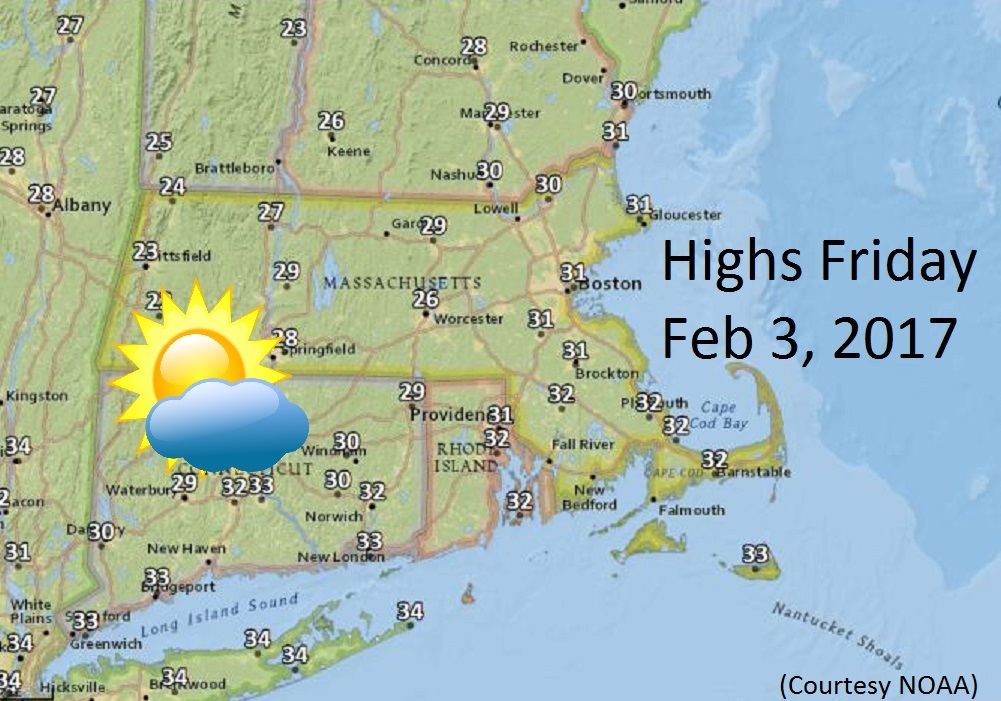
Friday: High clouds with some sunshine. Highs: 27-32.
Friday Night: Partly cloudy. Lows in the upper teens.
Saturday: Partly sunny, breezy and cold. Highs around 30.
Sunday: Mostly cloudy. Highs in the mid-30s.
Monday: Partly sunny with increasing clouds at night. Highs near 35.
Tuesday: Cloudy with snow starting in the morning, changing to rain by evening. Some accumulation is possible before the changeover. Temperatures will rise into the 30s.