Advertisement
Forecast: Clearing Skies Today; Uncertainty About How Storm Friday Will Unfold
Overnight rain added to the March rainfall total and did more to wipe away a multi-year drought.
The drought isn't over, but if this pattern continues, it will be all but dead come mid-April. This won't mean it can't rear its ugly, dry head again over the summer, but I'm starting to be a bit less concerned about the start of spring.
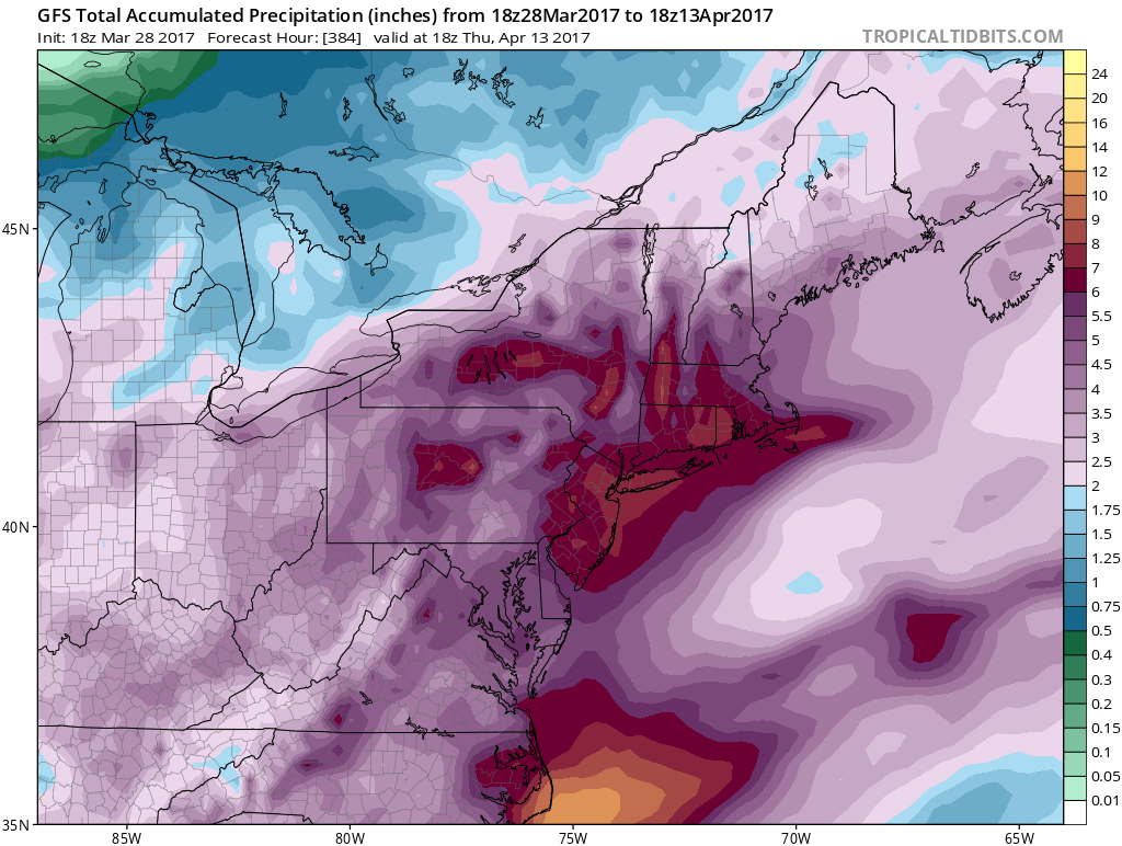
The map below shows how much rain is predicted over the coming two weeks. First, the map won't be entirely correct. However, it is one of the first times in a couple of years I've seen this amount of rain consistently predicted by the models, which is a good sign and a welcome trend.
After two rain events this week, we have a third one on the way for the end of the week and the start of the weekend. This is going to be a borderline rain/snow situation and does bear watching.
A change in predicted temperatures by a handful of degrees Friday night will determine how much rain we're likely to get and the rules we use to measure the storm's precipitation. We may not fully know the exact rain/snow line until very close to the start of the storm, and even then, it will likely waffle east to west.
The storm will arrive Friday afternoon and end Saturday morning. If you end up in an area that does see snow, it will be heavy and wet and could create power outages. This is just a preliminary forecast and a lot can and will change by my new update Thursday morning.
There are signs of more rain later next week and perhaps a couple more periods of wet weather before the Boston Marathon. We haven't had a wet spring in a few years. We are certainly due.
You can follow my updates on Twitter at @growingwisdom.
Wednesday: Early clouds, then clearing. Highs nearing 50.
Wednesday Night: Mainly clear and cool. Lows just around freezing.
Thursday: Mostly sunny and seasonable. Highs 45-50.
Friday: Sun and clouds. Rain or snow developing continuing at night. Highs 38-43.
Saturday: Rain, may be mixed with snow early. Highs in the low 40s.
Sunday: Mostly sunny and cool. Highs 43-48.
