Advertisement
Forecast: Breezy To Windy Conditions With Some Showers From Weakening Jose
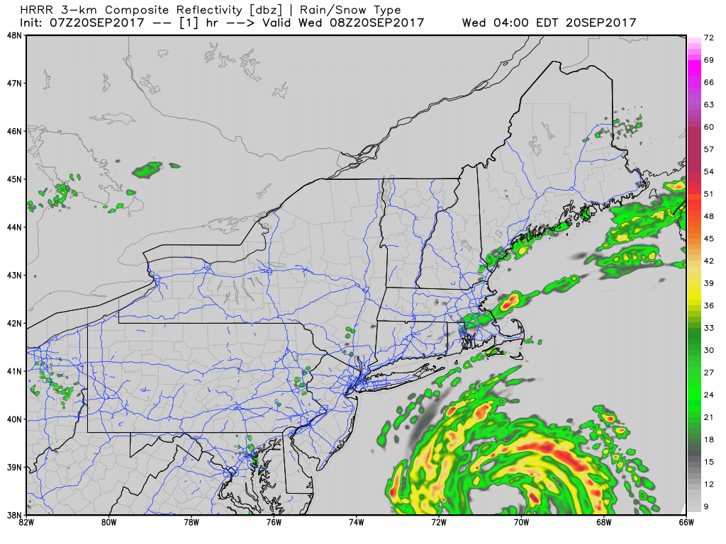
ResumeAs expected, Jose made the turn toward the east overnight and also was downgraded from a hurricane to a tropical storm.
The tropical storm warning from Hull to Plymouth has been dropped and replaced with a wind advisory. This wind advisory includes Boston. The tropical storm warning is still posted for Cape Cod and the Islands, where winds could reach over 39 miles per hour.
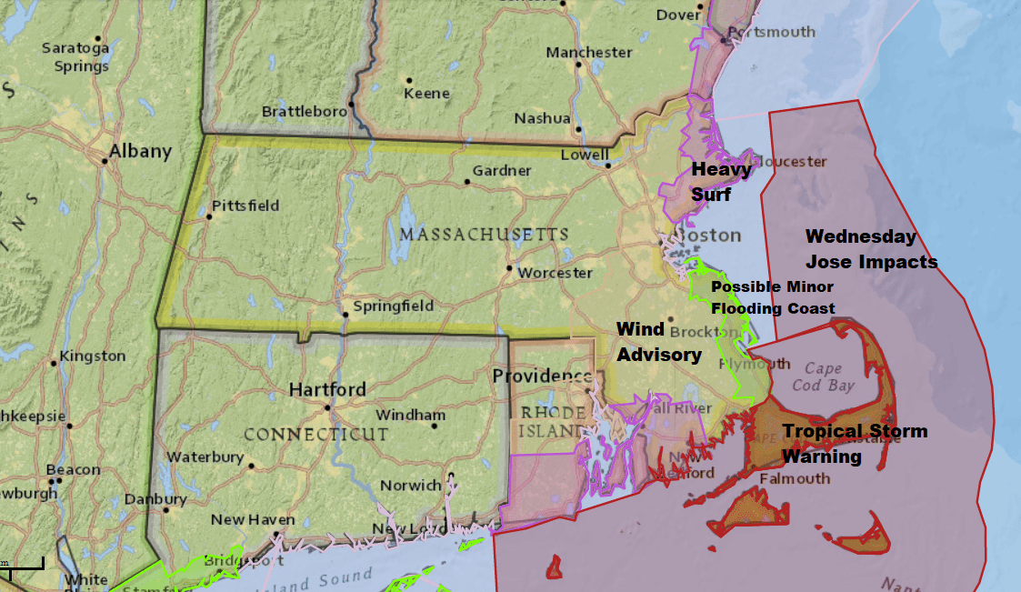
The wind is going to be the weather feature you will notice today and Thursday, and if you live on Cape Cod, Martha's Vineyard or Nantucket, that wind may still around into the weekend. Although, the gusts will not be as strong by then.
Rainfall will not amount to much around Boston, perhaps as little as a tenth of an inch to three quarters of an inch if an isolated downpour occurred.
Street flooding won't be an issue for most places in this storm. There could be some heavier rainfalls with minor street flooding on Cape Cod today, but even there, the rain will be manageable.
Losing A Lot Of Sand
There will be some beach erosion, especially on those beaches facing the ocean on the outer Cape, the south and east side of Nantucket and the south side of Martha's Vineyard.
Storm Lingers At Coast
Clearing starts to take place on Thursday west of Route 495 in the afternoon and spreads east for Friday. Cape Cod and the Islands may not see sunshine until the weekend as Jose or its remnants remain close enough for clouds there into Friday.
Inland areas will reach the upper 70s Saturday and low to even mid-80s on Sunday. That's quite a summer pattern!
Hurricane Maria Still A Dangerous Storm
Hurricane Maria is hitting Puerto Rico and its islands very hard this morning. The damage from this storm will be terrible, and Maria will continue to move into other parts of the Caribbean today. We will need to watch this storm closely, but present models keep the storm from hitting the United States' mainland.

You can follow my updates here and on Twitter @growingwisdom.
Wednesday: A period of showers or a steady rain over Nantucket and the Cape. Chance of showers elsewhere. Cloudy. Breezy to windy on Cape Cod.
Wednesday Night: Cloudy with a small risk of a shower. Best chance of precipitation is over Cape and the Islands. Lows 61-65. Breezy inland and windy at the coast.
Thursday: Sun and clouds well inland. Cloudy on the Cape and the Islands. Highs in the mid-70s; 68-72 coast.
Friday: Partly to mostly sunny. Cloudy on the Cape and Islands. Highs 68-74.
Saturday: Mostly sunny. Highs in the mid-70s.
Sunday: Mostly sunny and warm. Highs in the 70s coast, low to mid-80s well inland.
This segment aired on September 20, 2017.
