Advertisement
Forecast: Dry Pattern Overall This Week
A dry pattern typically doesn't bring a lot of snow, so we'll have to see whether or not our dry November continues through the core of winter. Whatever happens in the months ahead, the next few days are definitely going to be dry.
Today we find a cold front ready to push through the area. Temperatures will be seasonable but there's going to be a brief blast of cold air late this afternoon and overnight tonight. This cold air won’t last long, but you’ll notice it.
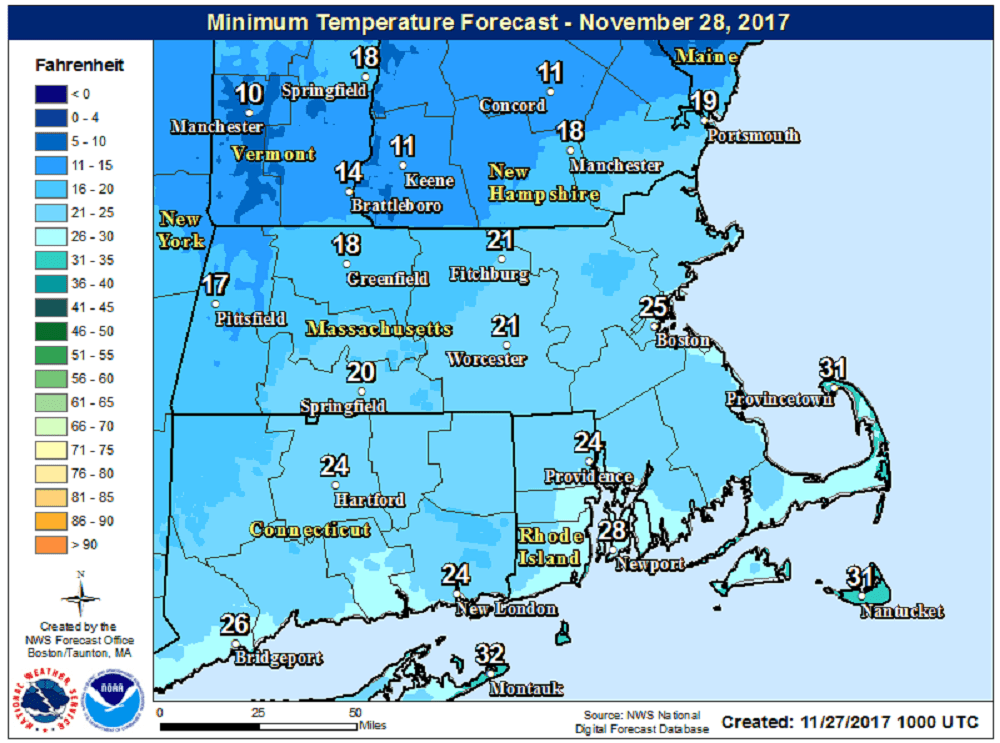
When you get up on Tuesday morning it will be quite chilly and feel like winter. The air will be dry and crisp and you’ll want the hat and gloves for the morning at least. Lows will be in the 20s for most of us, but some teens are likely north and west of Route 495 and especially into southern New Hampshire.
Light winds and abundant sunshine make it feel pleasantly cool Tuesday afternoon with a real warm-up for Wednesday. That day features temperatures in the 50s.
The dry weather continues into Thursday, but some showers are likely Thursday night or Friday morning as a weather system affects the region. The amount of rainfall and the timing of this is still questionable, but presently it doesn’t appear to be an important system.
You can follow my updates here and on Twitter @growingwisdom.
Monday: Generally sunny and seasonably cool. Highs in the mid-40s.
Monday Night: Clear and cold. Lows 21-27, but a few teens north and west of Route 495.
Tuesday: Sunshine and cold to start, but warming to 40-45 in the afternoon.
Wednesday: Sunshine, breezy and milder. Highs in the 50s.
Thursday: Sunshine followed by clouds. Highs in the mid-40s.
Friday: A period of showers, mainly early. Highs in the lower 50s.
