Advertisement
Forecast: First Snowstorm Of The Season Arrives Saturday
ResumeThe first snowstorm of the season will get underway this morning and continue through the afternoon and into the evening hours. The heaviest of the snow will fall between about 1 p.m. and 8 p.m. There will be some light snow before and after that time frame. After most of the snow has fallen by midevening, any snow showers late tonight won't amount to very much. However, some roads may need a sanding if they have been cleared early.
Speaking of the roads, conditions will definitely become slow today. If you don't enjoy driving in the snowy weather, I suggest you are home by about lunchtime.
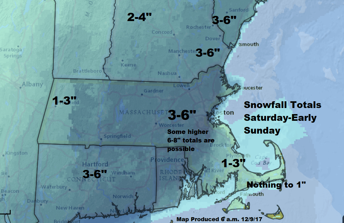
This isn't going to be a blockbuster snowstorm, although some areas could top out in the 6 to 8 inch range after a general 3 to 6 inches for most areas. The greatest likelihood of the heaviest snow would be from about Boston southwest over the interior. There may also be an enhanced area over parts of Essex county. Determining the exact location of the so-called "jackpot" is a bit more difficult but you should be aware that this could occur.
There won't be any coastal flooding or big winds with this storm. Temperatures throughout its duration will be in the upper 20s to mid-30s with the coldest air west of Route 495. The snow will be lightest in texture in that area. Closer to the coastline, the snow will have a wetter consistency. Right along the coastline, the snow may become quite heavy. These areas could see some scattered, fallen tree branches.
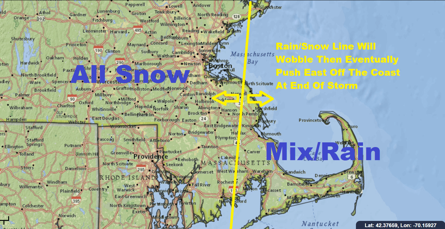
The first inch of snow should be on the ground between about 1-2 p.m. this afternoon in the Boston area, a little earlier further southwest. For those of you on the Cape and the Islands, you may start with some snow but it will quickly change to rain and remain there throughout most of the storm. At the very end of the storm as the precipitation pulls away, there could be a coating of snow in those locations.
The sun will return later Sunday afternoon with temperatures remaining in the upper 30s. There is a weather system for Tuesday but I don't expect much in the way of snow or rain showers. Behind that system, however, the coldest air of the season will move in and temperatures will remain in the teens and 20s for the rest of the week.
You can follow my updates here and on Twitter @growingwisdom.
Saturday: Cloudy, snow developing mid- to late in the morning or early afternoon well north. Highs in the upper 30s. Look for mainly rain on Cape Cod.
Saturday Night: Snow heaviest before 8 p.m., then lighter snow showers. Lows 27-33.
Sunday: Early flurries, then partly cloudy and chilly. Highs in the upper 30s.
Monday: Sunshine and a few clouds, cool. Highs in the upper 30s.
Tuesday: Some rain or snow showers. Highs in the upper 30s.
