Advertisement
Forecast: Heavy Snow Turns To Rain In Afternoon
ResumeAfternoon Update --
The snow arrived as scheduled late this morning. Now we will watch the rain-snow line slowly move into Boston before heading north and west. The amount of snow forecast should still hold.
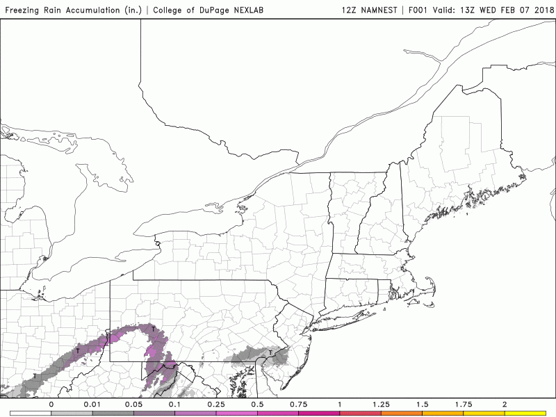
There's likely to be a period of freezing rain inland, especially west of Route 495, this evening. If you are headed north and west of Boston be aware of changing road conditions.
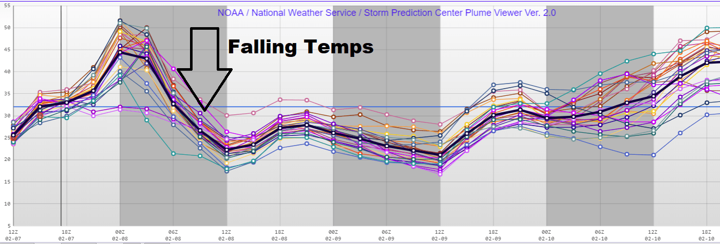
Temperatures will fall overnight and any remaining slush will freeze solid. This won't be a flash freeze, per se, but temperatures will be 10 degrees under the freezing mark by morning.
Our Earlier Morning Post --
Depending on when you read this, the snow may or may not have begun across the region, but we all should get through the morning commute without any weather problems.
Snow is forecast to arrive in Greater Boston around 11 a.m. before changing to a mix of rain and snow sometime between 2 and 4 p.m.. Then, the area will see rain after 4 p.m. In other areas, a mix of snow and rain will arrive a bit earlier or later, depending on when warm air from the south comes in to push the snow north.
Snow will be coming down at a relatively heavy clip. Once the snow begins we will see about an inch of snow every 60 minutes until it changes to rain. The longer it takes for the rain to settle in, the more snow the area will see.
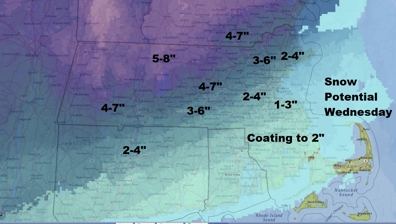
The changeover to rain will come quite quickly over Cape Cod and the Islands, and so I'm not expecting much or any snow accumulation. As you move northward, the storm ramps up to 2 to 4 inches, especially just north and west of downtown Boston.
Farther north, across the Route 2 corridor, there will be mostly snow falling during the storm. The area will see the heaviest amounts of snow, and it's likely some spots will see more than 6 inches.
Everything winds down overnight as rain, but temperatures will drop well below freezing. This means any slush and snow will freeze and become rock solid on Thursday.
Thursday is bright, sunny and cold. The weekend is going to be unsettled with a bit more snow, but there will not be a big storm Friday. There will perhaps be rain over the weekend. Either way we won't see much sun for a while after tomorrow.
You can follow my updates here and on Twitter @growingwisdom.
Wednesday: Snow developing after the morning commute. This changes to rain from south to north after a few inches in Boston. There could be some icing as well. Highs in the 30s.
Wednesday Night: Rain or mix precipitation ending. Clearing by morning. Lows 19-24.
Thursday: Cold with sun and clouds. Highs 35.
Friday: Cloudy and cold. Maybe some snow showers. Highs in the lower to middle 30s.
Saturday: Cloudy, some spotty showers. Highs around 40.
Sunday: More clouds, some rain possible. Highs in the lower 40s.
This article was originally published on February 07, 2018.
This segment aired on February 7, 2018.
