Advertisement
Forecast: Overnight Snowstorm Before Mild Air Returns
ResumeSunshine is greeting southern New England this morning with a colder air mass in place. Temperatures are well below freezing and setting the stage for the snow overnight tonight. Confidence has grown with the upcoming system so that it's highly likely all of us will see a plowable storm. The heaviest snow looks to be just south of the Massachusetts Turnpike down into the Rhode Island area, but even in Boston 4 to 6 inches of snow is likely.
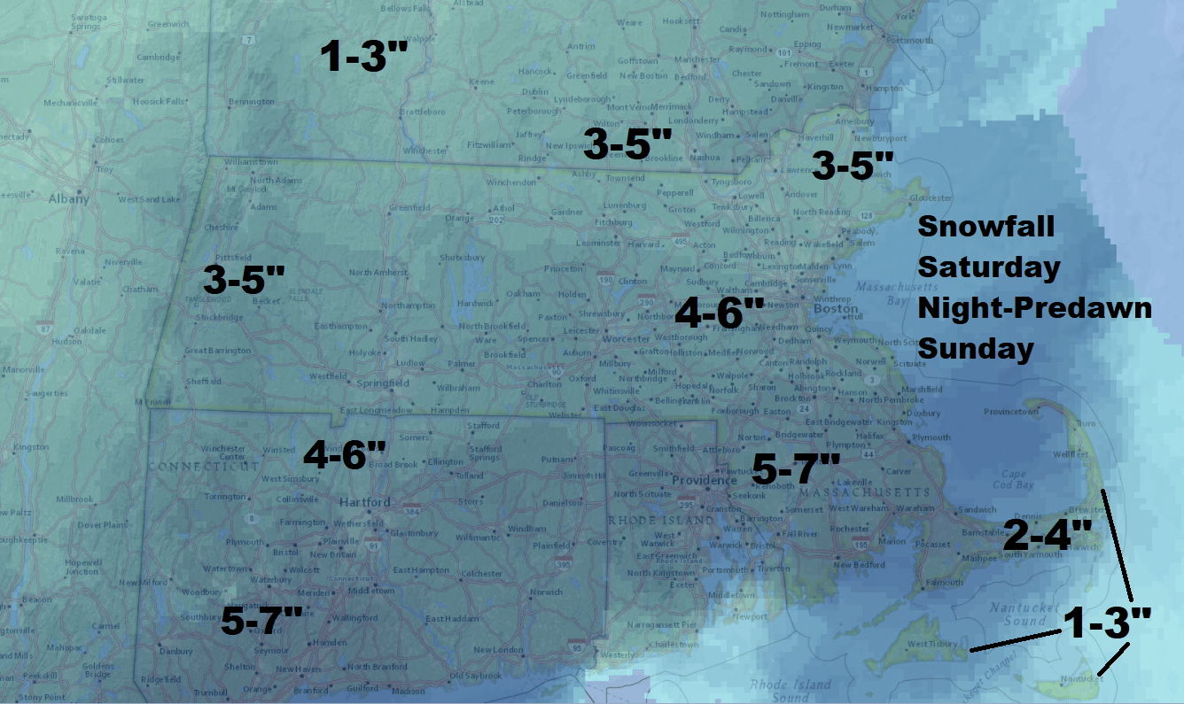
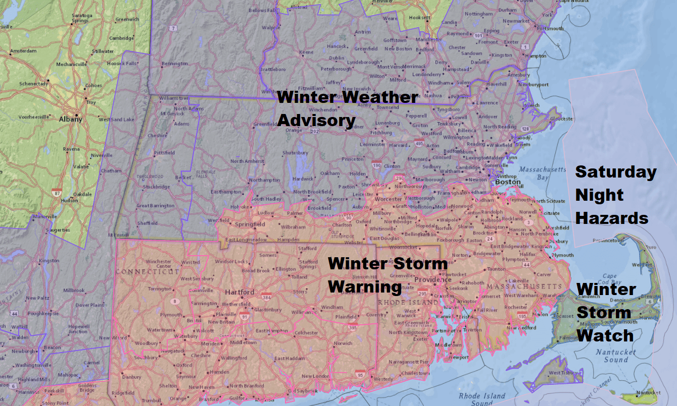
The most uncertain part of the forecast is for Cape Cod. This is where temperatures will be marginal overnight and the precipitation could fall completely a snow or a mixture of snow and rain. This will make the difference in total accumulation. The map below shows the cape and the islands having anywhere from 1 to 4 inches of snow but if temperature stay a little bit colder then there would be 5 to 7 inches in these areas as well. This is why the National Weather Service is continuing the winter storm watch as of Saturday morning because of the lack of confidence in the temperature profile.
Dry Evening To Start
If you have plans this evening there won't be any snow until around 9. the further west and south you are from the Worcester area the better chance the snow would arrive before that time and the further north and east you are from Boston the later in the evening the snow will arrive. The heaviest will fall between about 11 p.m. and 6 a.m. The final flakes should fall before 9 a.m., with sunshine quickly returning.
If you're wondering whether you should shovel or just let it melt, part of the answer comes with the fact that you may have to shovel just from a legal standpoint. But if you can avoid shoveling, it will be gone by Monday afternoon. This is because temperatures are going to warm into the forties tomorrow and Monday and then get into the sixties Tuesday and Wednesday. There's even an outside chance we could see a 70-degree reading in the middle of next week.
One last point about the snow: it will be heavier and wetter than some of our past storms, and there's the possibility of a few scattered power outages in those areas that have the heaviest snow as well as the highest accumulation.
You can follow my updates here and on Twitter @growingwisdom.
Saturday: Colder with sunshine, then late day clouds. Highs in the mid-30s.
Saturday Night: Snow overspreads the region. Heavy at times. Mix or rain possible Cape Cod and Island. Lows 29-36.
Sunday: Early snow, then sunshine. Highs 39-45.
Monday: Mild again with sunshine, but some showers late. Highs 39-45.
Tuesday: Breezy and warm. Highs 58-67.
