Advertisement
Forecast: One Coolish Day, Before The Heat And Eventual Humidity
This morning we find a weather system pushing south of New England from the north and this has ushered in cooler air. This temperature change is only going to last for 24 hours, as we are in a fairly warm and dry pattern overall.
Clouds and showers this morning will end and clear up this afternoon, with temperatures in the 60s to 70s. The air will feel crisp as humidity levels will stay low. Tonight's temperatures could go as low as the 50s, making it great sleeping weather.
Beach Weekend
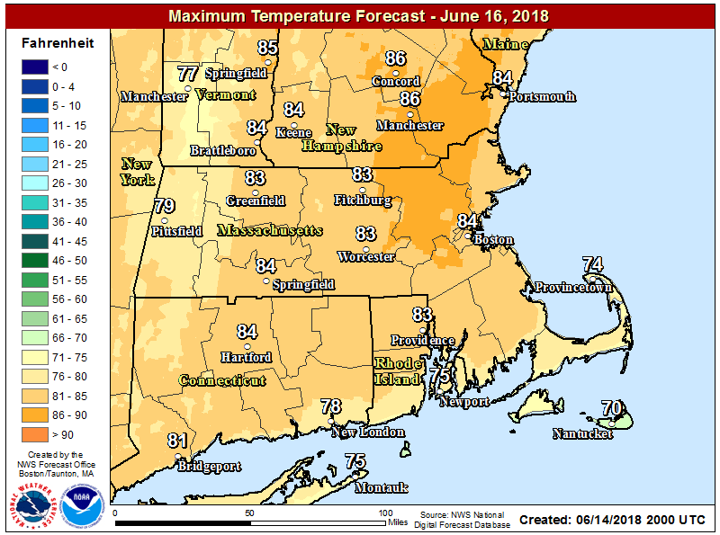
Either or both days this weekend will be great beach days. Temperatures over Cape Cod and the Islands will be in the mid to upper 70s both Saturday and Sunday, but inland areas, as well as the coast near Boston, will reach the 80s to near 90. The other place that will be cooler is the outer tip of Cape Ann.
Tides are high in the mid-afternoon time frame, but check your local tide chart for the exact time.
The weekend will stay pretty dry. As the high pushes offshore Sunday night and into Monday, temperatures and the humidity will rise. I expect readings into the 90s on Monday, and when you add in that moisture in the air it's going to feel near the century mark during the middle part of the afternoon.
It does turn less hot Tuesday and Wednesday of next week but still way above average. It looks like summer is arriving early this year.
You can follow my updates here and on Twitter @growingwisdom.
___
Friday: Early clouds and even a quick shower, then partly sunny and mild. Highs 68-74.
Friday Night: Clear and comfortable. Lows 52-58.
Saturday: Dry and warm. Highs into the 80s. 70s Cape/Islands.
Sunday: Sunny and turning hot. Highs 85-90. 70s Cape/Islands.
Monday: Partly sunny, humid, late day storm possible. Low to mid-90s inland. Feeling near 100 in the afternoon. Cooler Cape/Islands.
Tuesday: Warm and dry. Highs around 80.
