Advertisement
Forecast: Intense Heat Could Close Out June
Some much-needed rain fell overnight and now we have a cool day. Temperatures will remain in the 70s, and there is a risk of showers today as well.
As a weak system pushes offshore, overnight skies clear and that's going to set us up for a couple of nice days Tuesday and Wednesday. Another system brings the chance for a period of showers on Thursday before the weather pattern undergoes a major change.
There's no way for me to predict whether or not the upcoming heat is going to be the worst of the entire summer, but the last couple of days in June and the beginning of July can often bring some of the warmest conditions of the summer season. Consider it the exact opposite of how January can bring some of the coldest temperatures of the year.
A big ridge of high pressure is going to build over the eastern half of the United States and this will allow the strong summer sunshine to heat the atmosphere to extreme levels. It's still early to know just how hot it is going to be this coming weekend and early next week, but there is the possibility for some records. This is the type of heat which requires heat advisories or perhaps even warnings. While some of you really enjoy the hottest weather of summer, once we get into the upper 90s with humidity it becomes difficult to really take advantage of the summer heat.
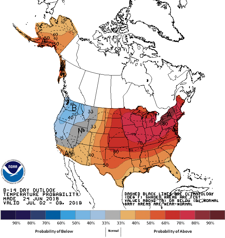
An official heat wave lasts for three days, with temperatures at or above 90 degrees every day. A prolonged heat wave could be possible starting this weekend.
You can follow my updates here and on Twitter @growingwisdom.
Monday: Clouds, some sun a shower or two possible. Mid-70s for highs.
Monday Night: Clear and comfortable for sleeping. Lows 47-55.
Tuesday: Sunshine. Highs 75-80.
Wednesday: More sunshine, warm. High around 80. Cooler Cape.
Thursday: Muggy with a few showers. Highs in the mid-70s.
Friday: Still dry and warm. 80s to near 90; 70s Cape/Islands.
