Advertisement
Forecast: Great Vacation Weather Continues
A cold front swept through the area overnight, ushering in Canadian air and pushing the 90-degree weather out to sea. Any cloudiness we see this morning will quickly depart and I'm looking for a generally sunny day, with temperatures staying mostly in the 70s at the coast, though a few spots inland could nudge 80.
The weather remains dry for the foreseeable future, as high pressure keeps in control and doesn't allow much in the way of shower or thunderstorm activity. It's going to be quite seasonable for the next several days, but as we head toward the weekend it will begin to heat up again. The humidity will also be comfortable through Friday prior to increasing late in the weekend and early next week.
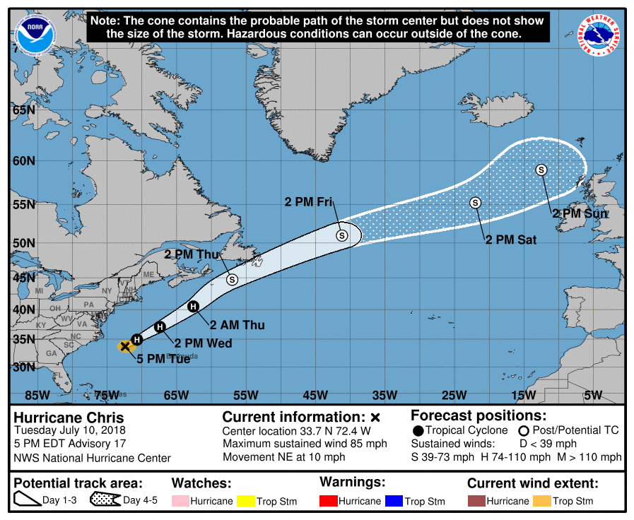
Hurricane Chris continues to move off towards the north and stay well off the U.S. coastline, but it will bring some swells to the coast, as well as the potential for some riptides. Astronomical tides are also going to be high starting tonight and throughout the weekend.
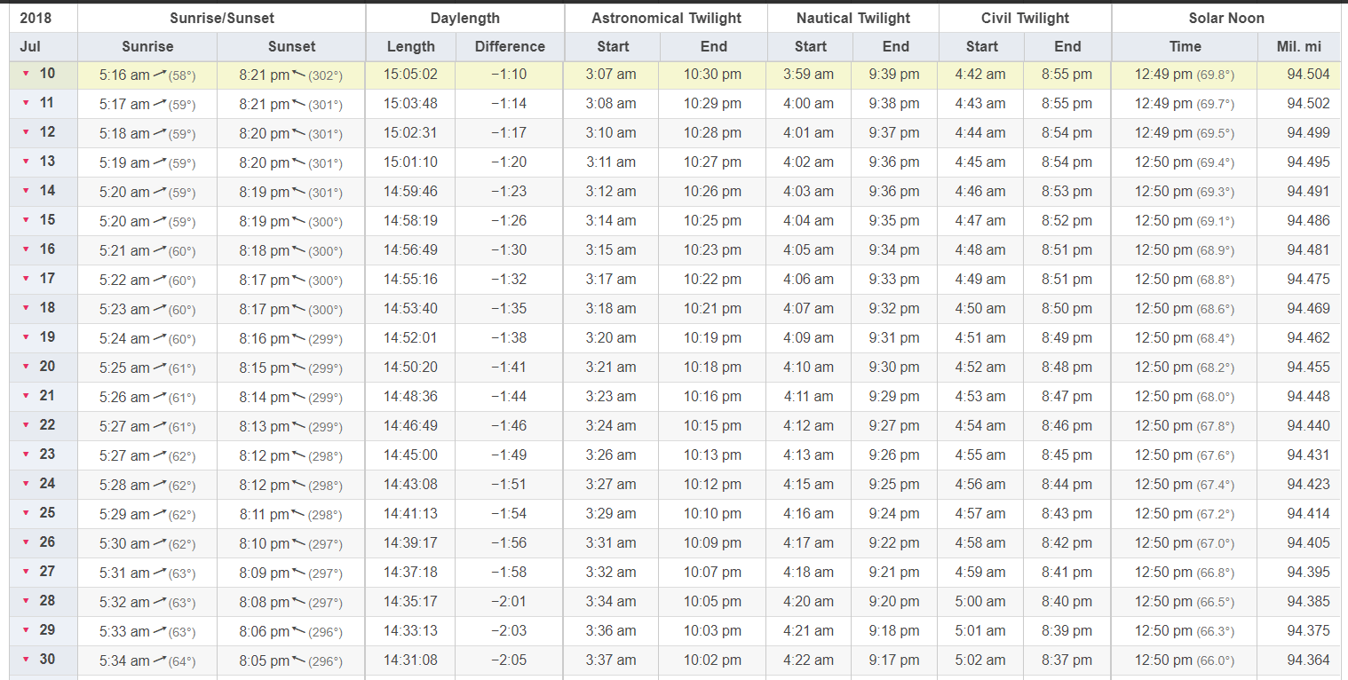
While sunrise and sunset are still early and late, we are losing time more rapidly each day and over the next few weeks we will go from losing a minute to losing two minutes a day. If you haven't noticed it in the evenings yet you certainly will by the end of the coming week.
You can follow my updates here and on Twitter @growingwisdom.
Wednesday: Early clouds; otherwise more sunshine, warm. High just under 80, 70s coast.
Wednesday Night: Clear and comfortable. Check out Mars and Venus if you are in a clear spot. Lows 56-64.
Thursday: Sunshine and warm. Highs in the lower 80s.
Friday: Still dry and warm. 80-84, 70s Cape/Islands.
Saturday: Lots of sunshine. Highs in the low to mid-80s, may be near 90 on Sunday.
Sunday: Still dry and warm. 84-89. Cooler coast.
