Advertisement
Forecast: Oppressive Heat And Humidity Continues; Heat Advisory Until Tonight
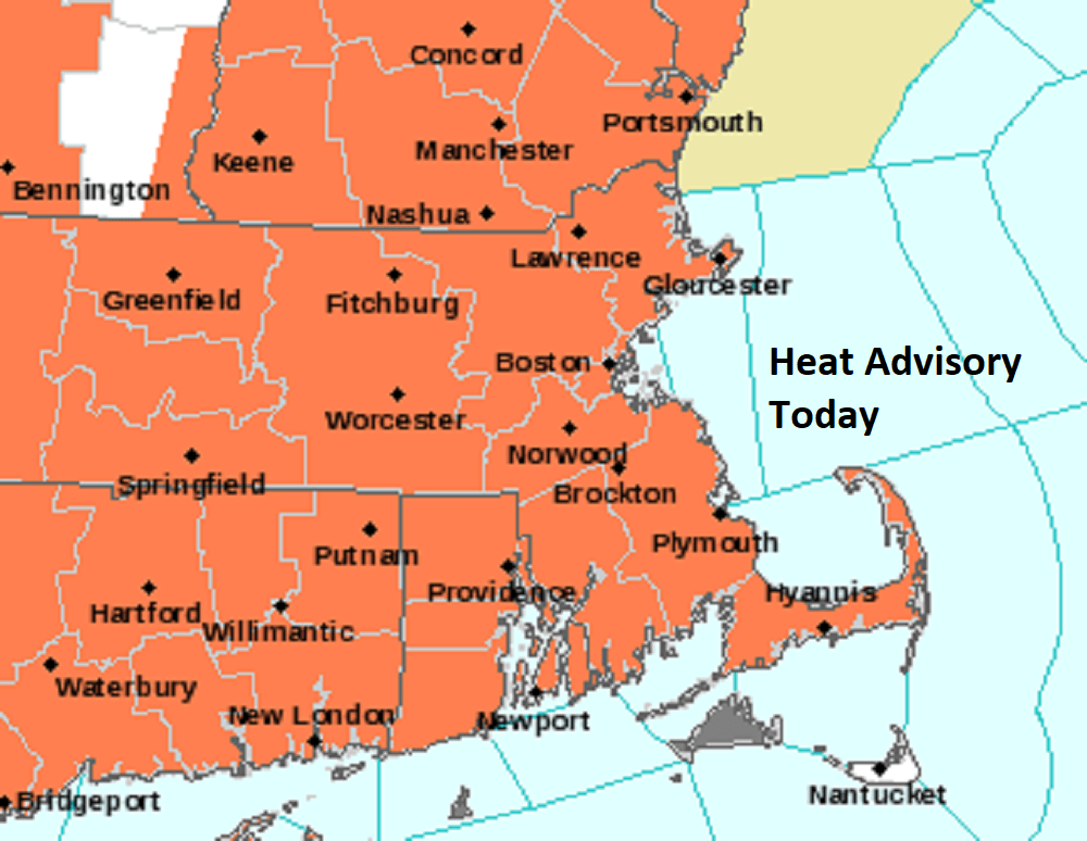
The heat is on again Tuesday, with temperatures reaching well into the 90s along with oppressive humidity. Most of the state, with the exception of Martha's Vineyard and Nantucket, is under a heat advisory until 8 p.m. The afternoon highs will be in the mid-90s, with heat index values between 97 and 102.
The first seven days of August are going to end up as the warmest first week of August ever recorded. What's interesting is that the first week of January this year was also the coldest. Therefore, in the span of one year we've seen one of the coldest and one of the warmest weeks on record. This is New England and extremes are part of living here. This is even extreme for the extremes.
If you're wondering when we're going to see a break in the heat, the answer is at the end of the week, when temperatures will no longer into the 90s. We will also see a lowering of the humidity, although it's not going to be cool Canadian air.
There is a chance of thunderstorms this afternoon and a better chance for Wednesday.
Thursday morning we run the risk for a quick early shower and then sunshine returns along with another warm day.
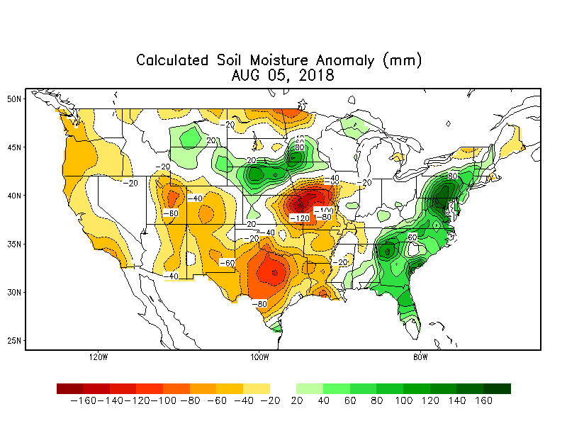
Until an area of high pressure that's out in the Atlantic breaks down, we're not going to get more comfortable summer air. This could last the entire month with only minor exceptions. The one good thing that has happened over the past several weeks is that there has been adequate rainfall so although it's warm, the soil moisture is at good levels. With the humidity it's tough for things to dry out very much during the day.
By the way, if you think it's been warm around here in Albany, New York, the high temperature hasn't been under 80 degrees since late June for 40 days. This has shattered the previous record of 29 days for the most consecutive 80-degree high temperatures in a row.
You can follow my updates here and on Twitter @growingwisdom.
Note: It will be very humid again this week.
Tuesday: Mostly sunny and hot. Inland storm possible. Highs 90-95. Cooler Cape/Islands.
Tuesday Night: Very warm and muggy. May shower late. Lows 70-75.
Wednesday: Sunshine/clouds. Afternoon showers and storms possible. Highs in the upper 80s to low 90s. 78-85 Cape/Islands.
Thursday: Sunshine and clouds, not as hot. Highs in the 80s. Scattered showers early.
Friday: Sunshine and clouds. Warm highs in the mid-80s.
Saturday: Sunshine and clouds, brief passing shower, but mainly dry. Highs 81-86.
