Advertisement
Forecast: Dry Air Is Back For A Couple Of Days
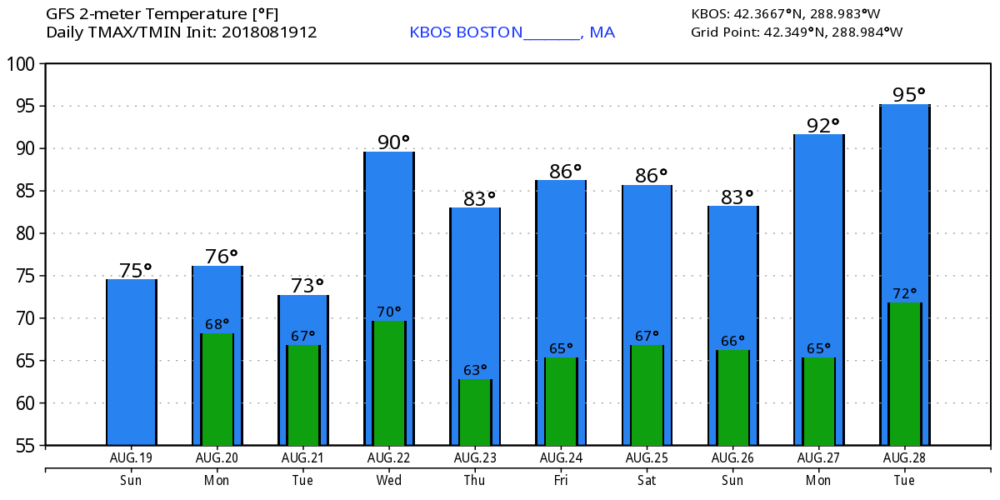
If you've been tired of the humidity than yesterday was certainly a great day to enjoy a much cooler breeze and more comfortable air. This nice pattern will last another couple of days before we have one day of high humidity on Wednesday. There's also the chance of a couple of showers on that day, along with a possible thunderstorm.
Once the frontal system passes offshore later Wednesday, it's a return to seasonably warm temperatures and comfortable levels of humidity into the weekend. I'm not looking for a lot of rain on Wednesday, although with the added moisture in the air there could be some heavy downpours.

The longer-range models are forecasting more heat to develop as we close out the month of August. Depending on exactly how warm we get will determine where this summer places on the record books.
Although we've been through a wet period, it does look like it's going to turn drier after Wednesday and we may end up back in a drier-than-average month.
You can follow my updates here and on Twitter @growingwisdom.
Monday: Clouds and some sunny breaks. Comfortably mild. Highs 73-78.
Monday Night: Partly cloudy and cool. Lows 57-62.
Tuesday: Sunshine and some clouds. Highs in the mid-70s.
Wednesday: Sunshine/clouds. May shower/storm. Highs in the upper 70s to low 80s. Quite humid.
Thursday: Sunshine and clouds, drier. Highs in the upper 70s.
Friday: Sunshine and clouds. Still dry. Highs around 80.
