Advertisement
Excessive Heat Warning Issued For Northeastern Mass.
As the night progressed the humidity went up and now we are into the purely tropical air and looking at a very hot day ahead. We won't break any records today, as the temperature would need to exceed 99, and I don't think that's going to happen.
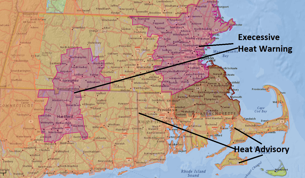
Record aside, it is going to feel like it's above 100 across much of north and eastern Massachusetts. The National Weather Service has issued an excessive heat warning for Boston up to Lawrence, and the South Shore, Cape and the Islands a heat advisory, both from 10 a.m. Tuesday to 9 p.m. Wednesday.
No matter where you are over the next couple of days, you want to take it easy. If you need to do any strenuous activity, try to get it done before 9 a.m., or do it in that hour before the sun goes down.
Actual temperatures both today and tomorrow will reach the 90s, making for the second heat wave of the year in Boston. But as I've said before, a "heat wave" is just the technical term. It's been one of the hottest summers on record, and this August will end up being the hottest August on record.
With the high amount of moisture in the air, it's going to be very difficult for the temperatures to fall much overnight tonight. I expect that it will remain in the 80s well into the night, finally falling into the mid-70s by morning.
Wednesday is a repeat of Tuesday. Temperatures could even been a couple of degrees warmer.
Relief is in sight, though — a cold front will slip through the area on Thursday and put an end to this heat. The weather looks more comfortable to start the weekend but I do see more warm weather although not as hot as we get toward Labor Day. Summer is going to be continuing for a while longer.
You can follow my updates here and on Twitter @growingwisdom.
Tuesday: Sunshine and very hot. Humid. Highs 91-96, feeling 99-105.
Tuesday Night: Partly cloudy and warm. Lows 70-76.
Wednesday: Sunshine/humid. Mid to upper 90s, cooler Cape and Islands. Records possible.
Thursday: Sunshine and clouds, shower or storm possible. Highs 88-94.
Friday: Sunshine and clouds. Less hot. Highs 75-80.
Saturday: Sunshine and clouds. Mid-70s. Coolest on the coast.
Sunday: Sunshine mixed with clouds. Highs 78-83.
Labor Day: Partly sunny. Warm. Mid-80s.
