Advertisement
Forecast: Rainy And Cool Start To The Week
Cloudy, cooler weather has temporarily replaced the heat and extreme humidity we’ve had for most of the summer. A warm front to the south will slowly move northward, bringing rain to the region later today and tonight with temperatures below normal for a change.
This will not last long. As the front moves to our north Tuesday, some humidity will filter back in again and the rain will turn more showery.
We are watching an intensifying hurricane in the Atlantic. Hurricane Florence is forecast to continue strengthening as it approaches the North Carolina coast on Thursday.
The storm is expected to stall near Cape Hatteras and then move northeast and out to sea east of New England by early next week. So far, we are leaning toward a scenario that keeps the rain and high winds off shore, with the only effect on our weather being cooler air wrapping around the back side of the hurricane next week.
We are not out of the woods yet as changes in the track and forward speed of the storm could cause it to move closer to New England. We will be monitoring the progression of Florence throughout the week.
Meteorologist Dave Goldbaum is in for meteorologist Dave Epstein
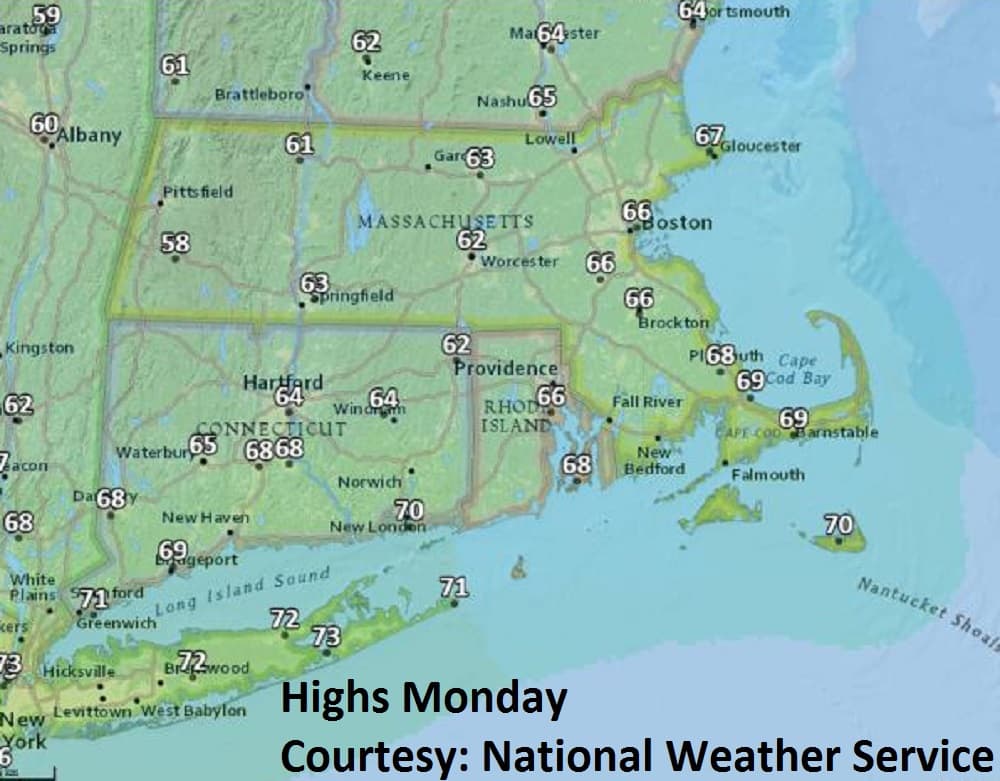
Monday: Mostly cloudy, breezy. Cooler than normal. Rain developing this afternoon. Highs in the mid-60s.
Monday Night: Cloudy with a few showers.
Tuesday: Clouds, some sun. Few showers, chance of a thunderstorm. Warmer, more humid, high 80.
Wednesday: Morning shower, otherwise mostly cloudy. Highs near 70.
Thursday: Partly sunny. Highs in the 70s.