Advertisement
Baker urges patience as crews begin to restore power in 'multi-day' storm cleanup
ResumeSpeaking after touring storm damage in Scituate, Gov. Charlie Baker urged patience as crews continued to clear trees felled during the two-day storm that wreaked havoc from New York City to Boston.
The high winds caused power outages for more than 465,000 customers, as of about 3:45 p.m. Wednesday. Baker said electrical workers would be able to safely climb into bucket trucks and work on wiring until the evening, when winds are expected to die down below 30 to 35 mph.
Restoring power will be a "multi-day" effort, he said.
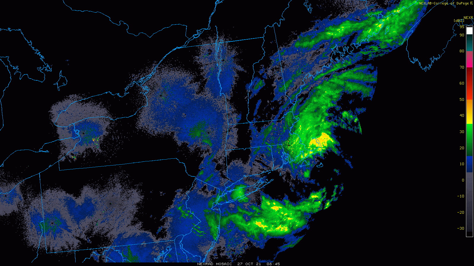
Images of downed trees, exploding transformers and vicious sea waves crashing into homes have dominated social media as residents take account of the damage.
The coastal nor'easter moving through the region became what's known as a bomb cyclone overnight, meaning it underwent a rapid drop in air pressure.
This process is called bombogenesis, and it's an indication that a storm is going to be quite strong. To become a bomb cyclone, a storm's pressure must drop at least 24 millibars in 24 hours; this storm's pressure dropped about 28 millibars from Tuesday morning.
As the low pressure became stronger, winds increased. Massachusetts has seen gusts over 80 mph in some coastal locations. The highest gust as of Wednesday morning was in Edgartown, at 94 miles per hour.
As the storm continues to pull off toward the south, the winds will slowly subside and our high wind warning along the coastline will expire this afternoon. There's still more rain rotating in off the ocean, which will continue to also move southward, tapering off to a drizzle, but I do not expect any clearing.
There won’t be any significant street or coastal flooding Wednesday, although there could be some minor issues at the time of high tide in the morning and beach erosion will continue through the morning and into the afternoon.
Both the MBTA's ferry service and the Steamship Authority suspended trips Wednesday due to the storm.
Service on some MBTA subway and trolley lines was also affected due to downed trees on tracks.
The T said some commuter rail service was also affected by the weather. You can check for service alerts and delays here.
Overnight, it will be breezy with a few breaks in the cloud cover. Thursday and Friday feature very similar types of weather, with temperatures in the low to mid-50s. There will be a lot of clouds, but a few glimpses of sun.
It will still be breezy on Thursday, but winds will be insignificant by Friday. Another rain storm arrives late Friday night. If you have any plans that evening, it should remain dry.
Showers are likely during the day Saturday and into the first part of the evening. Sunday looks to be mostly cloudy, with a few glimpses of sun and mild temperatures, with readings in the low 60s.
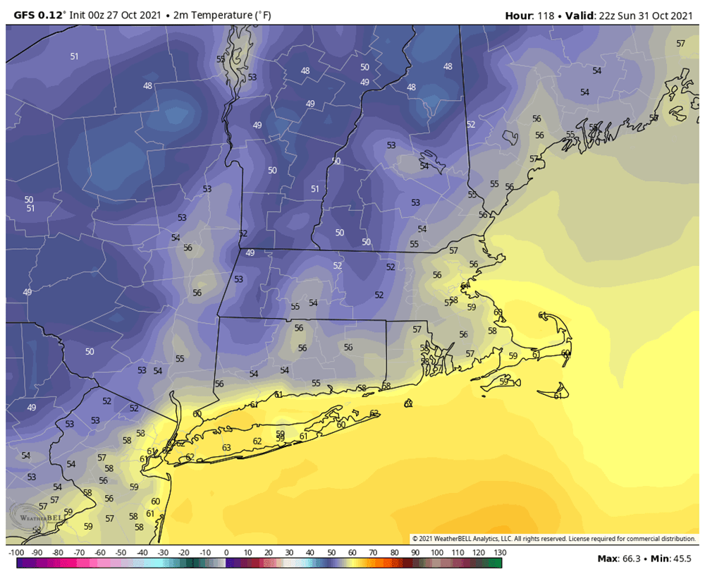
For trick-or-treaters Sunday night, it should be partly cloudy and about 55 to 60 as the kids are heading out, then falling to the 40s late at night.
Look forward to nice weather for the start of the coming work week.
This article was originally published on October 27, 2021.
