Support WBUR
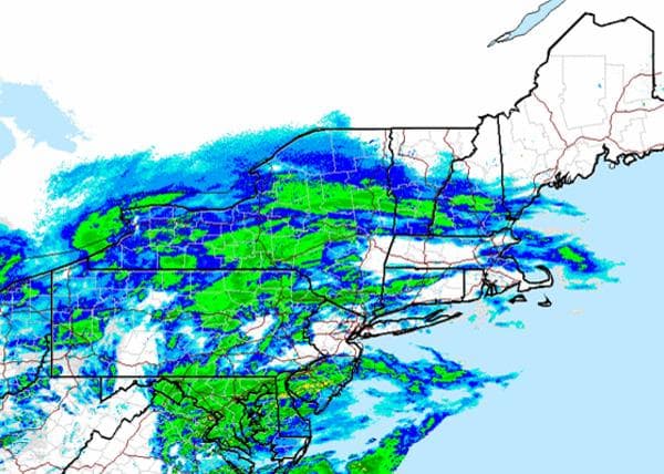
Winter Storm Moves Into New England
Get those snow shovels ready for action.
The National Weather Service says a storm will dump several inches of snow on much of southern New England on Saturday afternoon and evening.
WBUR meteorologist Mark Rosenthal said the latest forecast models showed more snow than first thought.
"It looks like Boston, out to 128 and 495, are now thinking in the range of 5 to 10 inches of snow before all's said and done," Rosenthal said.
A winter storm warning would be in effect at noon Saturday and last until 7 a.m. Sunday.
The National Weather Service says the snow should start falling early Saturday afternoon, with highest snowfall happening away from the coast.
"The worst of the storm is going to be overnight," Rosenthal said. "From 8 o'clock [Saturday] night until about 4 o'clock in the morning, it's going to snow at a pretty good clip and the winds are going to pick up from the northeast at about 15-35 miles an hour. It's going to look like winter around these parts."
No measurable snow has fallen in downtown Boston since Jan. 21, 2012. Rosenthal said this snow would likely break that unusual streak.
On Plum Island, work is underway to reinforce some homes at risk of damage from severe beach erosion. Rosenthal expected the winds from this storm to be weaker than the last Nor'easter, which packed wind gusts of 50-70 miles per hour. Winds this weekend were forecast to be 15-30 miles per hour.
With reporting by The Associated Press and the WBUR Newsroom