Advertisement
Forecast: Colder, But Dry Day; Milder This Weekend
Yesterday felt like spring in the afternoon as high temperatures reached well into the 40s, the snow continued to retreat and the increasing strength of the sun could really be felt.
High pressure is now building in from the north. Highs of Canadian origin usually bring chilly conditions to the area. Today and tomorrow highs will average under the 30-year normals, but not by much. Tomorrow night a warm front will come through the area, and it’s back to the feeling of spring for the weekend.
Temperatures Saturday and Sunday will approach 50 degrees for a few hours each afternoon. This will be a good chance to get the car washed, clean up the yard a bit and just enjoy a mild weekend in the middle of February.
Next week turns stormy, but the details are still very much up in the air. Our computer models all agree the storm track is going to become active. They also agree there is likely to be a prolonged period of precipitation, but where this falls and what form it takes are both very much in question.
It may be that northern New England gets a lot of snow, and we see rain or everyone sees snow or maybe it goes out to sea. The point of this is you will likely hear a lot of different forecasts over the next few days, and no one really knows the outcome of next week’s storm. I will have many more details as we get closer to next week.
You can follow my weather updates on Twitter at @growingwisdom.
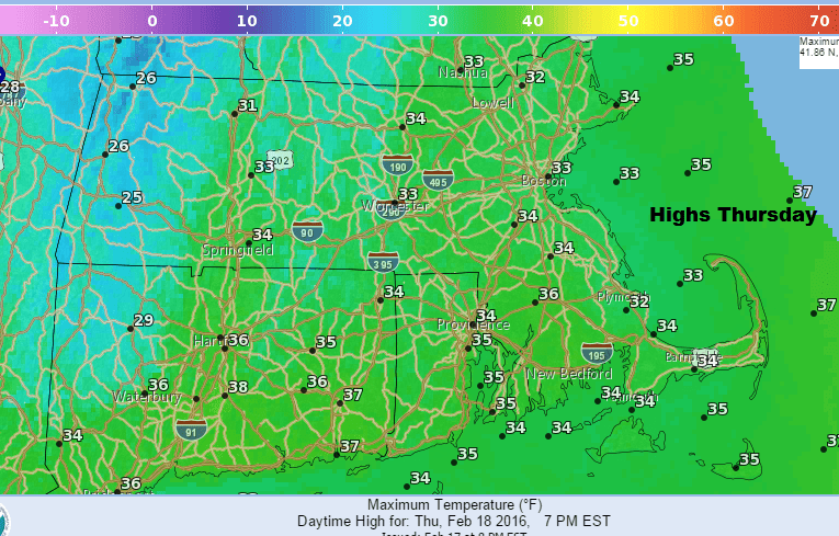
Thursday: Mostly sunny, with a high 32-38.
Tonight: Partly cloudy and colder. Lows 13-22.
Friday: Sunny, the clouding up late with a high near 38.
Saturday: Early rain and snow showers, then partly sunny and milder. Highs 42-47.
Sunday: Mostly sunny and mild. Highs 45-50.
Monday: Some rain or snow early, then partly sunny. Highs in the 40s.
