Advertisement
Forecast: Warm Tuesday, But Watching A Potential Storm Thursday
More rapid changes this week with a very mild Tuesday morning followed by cooler weather for the middle of the week. A frontal system will pass off the coast early Tuesday and bring an end to any rain. Winds will be brisk and it will feel like spring. Temperatures have already reached the high for the day and will fall throughout the afternoon. It will still be above freezing by the evening commute but in the 30s.
Wednesday is a dry and seasonably chilly day. Looks for highs about average, in the upper 30s.
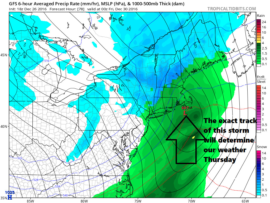
A storm will develop Thursday and bring a period of snow and rain. The exact track of the storm and the amount of cold air present will determine how much snow inland areas see and where the rain snow line sets up. Presently it appears to be a rain event for the coastal plain with snow west of Route 495. The best chance for significant snow is over northern interior New England. Even along the sea coast of New Hampshire and Maine the precipitation will likely turn to rain.
Behind this weather system the air turns colder. If there is still some moisture left on the ground we could be looking at more black ice developing Thursday night or early Friday.
Right now I don't see any issues with the First Night forecast, just dry and seasonably cold.
You can follow my weather updates on Twitter at @growingwisdom.
Tuesday: Early rain, then sun and clouds and mild. Highs occurring in the morning as temperatures reach the lower 50s then fall to the upper 30s during the evening commute. Winds will be gusty.
Tuesday Night: Clear and not very cold. Lows 27-33.
Wednesday: Sun and clouds. Highs in the upper 30s.
Thursday: Snow and rain, changing to rain. Highs near 40.
Friday: Partly sunny. Highs in the upper 30s.
Saturday: Sunshine and chilly. Highs near 30.
