Advertisement
Forecast: Mild Day Today, But Colder Pattern On The Horizon
Much-needed rain ended overnight washing away any remaining snow cover. My own yard was covered in ice Tuesday morning and now that has all disappeared. Temperatures today are going to average about 10 degrees above average with 50 degrees not out of the question in some neighborhoods.
Late this afternoon a cold front will usher in a new air mass full of cold, dry air from Canada. There could be a quick shower or even snow shower with this front.
Tomorrow is a sunny day. Temperatures will feel a lot colder. I don't expect highs to reach higher than the 32-degree mark, and with a gusty wind the first part of the day, a wind chill will be noticeable.
A rather weak storm system will pass to our south on Friday. This could bring a period of light snow to the area, mostly south of the Pike. There may be enough snow to make the Friday morning commute slow. More on this tomorrow.
Another storm will bring snow to parts of the southeast on Saturday. We will need to watch the forecast track of this system as it could impact our weather late in the weekend. Presently, I think high pressure to the north will keep the storm far enough south so as not to bother us.
Temperatures will continue to average below normal during the later half of the week and into the weekend.
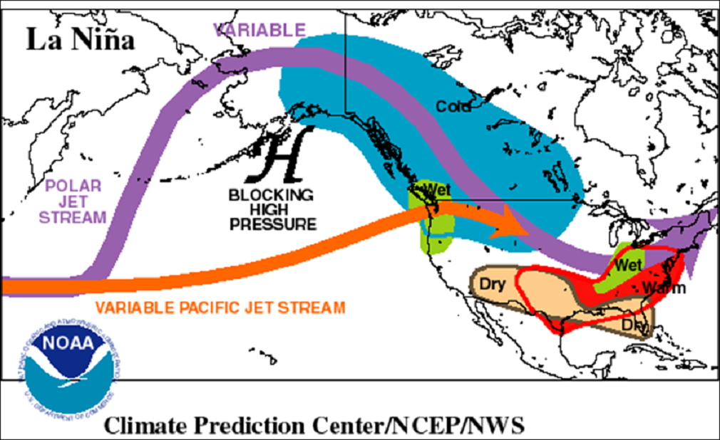
The pattern just isn't yet conducive to seeing any major snowstorms or prolonged arctic air. The La Niña — which is simply colder than average water temperatures off the coast of South America — continues to be a major play in our weather. The variability we are seeing between cold and relatively mild weather so far this winter is actually quite typical for a La Niña year. Look for more big swings in the coming weeks.
You can follow my weather updates on Twitter at @growingwisdom.
Wednesday: Partly sunny with a late-day shower possible. Highs in the mid- to upper 40s.
Wednesday Night: Mainly clear and colder. Lows in the mid-20s.
Thursday: Sunny and chilly. Highs in the mid-30s.
Friday: Cloudy, a period of snow possible. Highs in the upper 20s to mid-30s.
Saturday: Partly to mostly sunny and cold. Highs 28-32.
Sunday: Partly cloudy and cold. Highs in the mid-20s.
