Advertisement
Forecast: Wet And Windy Nor'easter Ramps Up Overnight
A strong nor'easter will bare down on southern New England overnight, coming to an end later Tuesday night before clearing for Wednesday.
This isn't a major storm in the sense it will bring a lot of snow or coastal flooding. However, winds will be quite strong overnight and rainfall will create some urban street and basement flooding problems. There is a coastal flood advisory for the time of high tide early Tuesday, but I don't expect anything more than minor coastal flooding and beach erosion to occur.
There are several parts to the storm. Lets look at each of them.
Wind Issues
Winds will continue to increase overnight with the strongest winds between 2 a.m. and 9 a.m Tuesday. The map below shows potential wind gusts during this time. I have chosen to show you the potential strongest gusts. These winds could cause power outages along the immediate coast. Inland areas can see power problems as well, but they are less likely there.

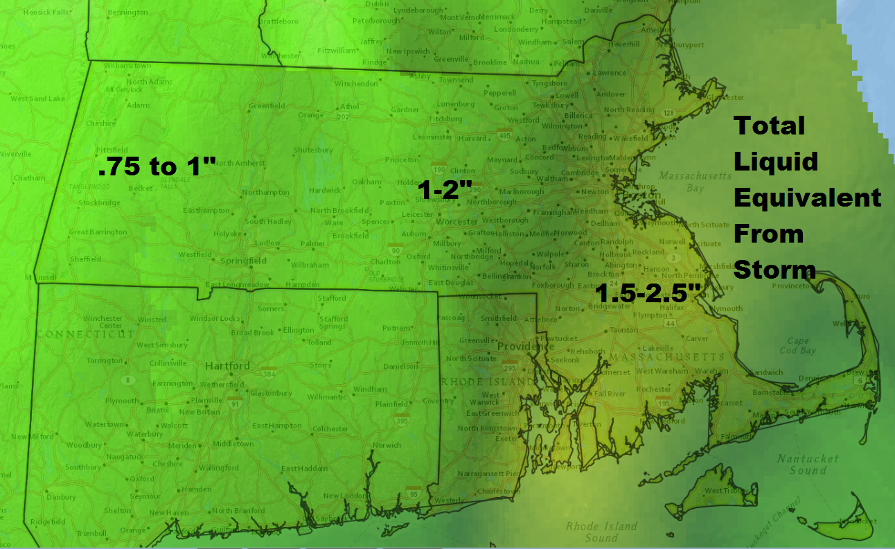
Rainfall Totals
The rain will become steady and heavy overnight. with sleet mixed in at times. Most of the rain falls by Tuesday morning, but there will be scattered showers and even a few downpours during the day and into Tuesday evening.
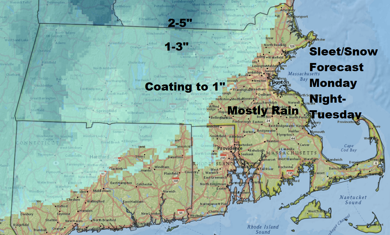
Sleet And Some Snow
There will be some snow and sleet early Monday evening even around the Greater Boston areas, but the primary accumulation of sleet will occur north of Route 2 and west of Route 495. The trend will be for the precipitation to change to rain early Tuesday.
Timing
The storm ramps up overnight and winds down Tuesday morning. While the heaviest rain and wind will have occurred by 9 a.m. Tuesday, the storm will still produce some lingering rain and even heavier downpours Tuesday afternoon and the first part of the overnight.
Clearing takes place on Wednesday with a return to sunshine and unseasonably mild air for January.
You can follow my weather updates on Twitter at @growingwisdom
Monday Night: Rain and wind. Some mixture of sleet and snow early in the evening. Lows in the mid to upper 30s.
Tuesday: Morning rain ends, then cloudy. Highs 43-48.
Wednesday: Sun and clouds. Highs 45-50.
Thursday: Mostly sunny and pleasant. Highs in the mid- to upper 40s.
Friday: Mostly sunny and seasonable. Highs around 40.
This article was originally published on January 23, 2017.
