Advertisement
Forecast: Snow Will Slow Evening Commute And Keep Falling Overnight
Update 4:45 p.m.
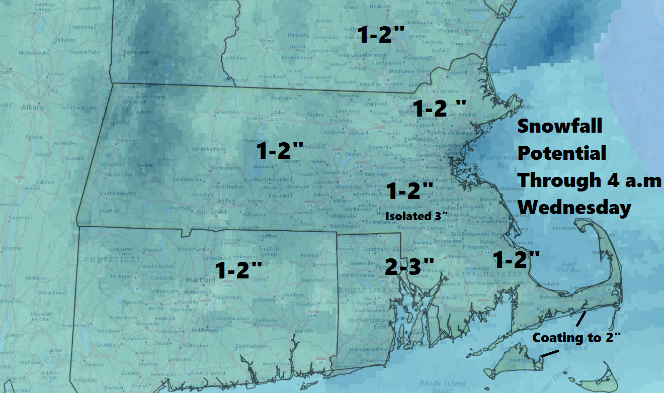
As expected, snow begin the Boston area just prior the evening commute. After an initial burst of snow this evening there will be a lessening of the snow's intensity and it may even stop. Another burst of snow in the midnight to 4 a.m time frame may bring another inch. In total most areas will see 1 to 3 inches of snow.
Earlier post:
The January thaw is over, and it's back to colder and snowier weather for the next couple of weeks at least.
The colder pattern is a result of the jet stream taking on a new configuration similar to what we saw at the end of December. These types of upper flows always bring cold, and often can bring snow.
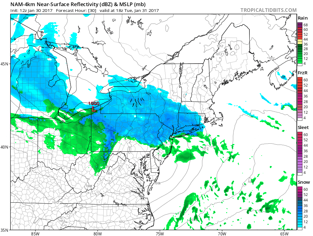
Today we are watching snow breaking out in New York and pushing east. Snow will arrive in the Worcester area before 2 p.m and in Boston an hour to two hours later. The timing of this system means the evening commute will be impacted, and I recommend planning accordingly.
I would say there will be at least an inch — maybe 2 — on the ground by the end of the evening commute, and there will be up to another inch in the wee hours of Wednesday morning.
The landscape will once again look like winter by Tuesday night, and when you get up Wednesday, February will look, well, like February.
This isn't a big snowfall. However, the January thaw has lasted a long time, and we haven't needed to drive in much snow since December. Another weather system coming Wednesday means some more snow is possible, but any snowfall will be much lighter than today's small storm.
Cold is also in the forecast. Temperatures the rest of the week and into the weekend will average slightly below seasonal norms, and that's something we haven't seen in quite some time either.
Dry weather returns Thursday and will last into the weekend. About the time the Patriots take the field Sunday night, I will be watching to see if a storm on the models does indeed bring more snow. It's too early to know what will happen and with the guidance we use showing conflicting predictions, it is all just speculation so far.
You can follow my weather updates on Twitter at @growingwisdom
Tuesday Night: Snow ends in the middle of the evening then another burst of snow after midnight. Lows in the mid to upper 20s. Another 1 to 2 inches of snow is possible.
Wednesday: Snow or snow mixed with rain will fall throughout the afternoon. There could be a few squalls. Light accumulation possible. Highs in the mid- to upper 30s, with a few spots near 40.
Thursday: Mostly sunny. Highs 31-36.
Friday: Mainly sunny. Highs in the lower 30s.
Saturday: Generally sunny and cold. Highs around 30.
This article was originally published on January 31, 2017.
