Advertisement
Forecast: Arctic Chill Arrives This Weekend
How about that wind yesterday?
What's amazing is there wasn't a storm close enough to bring us any precipitation. All that wind was caused by the difference in pressure between an area of high pressure and low pressure. Nature doesn't like imbalances, and therefore wind is her way of putting things closer to even. As the storm in Canada moved away, the wind relaxed.
Today we have an arctic front passing the area. This front will usher in even colder air for the overnight hours and Saturday. That day will likely end up one of the coldest days of the prior three months when you look at it in terms of high temperatures during that time.
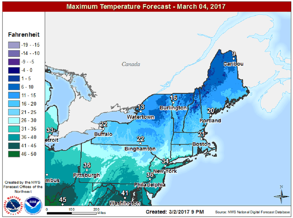
This last December, the temperature only reached 21 degrees on the 16th. On Jan. 9, the high in Boston was 20, and those are the two coldest days so far of the season. Saturday will be in that range.
Winds will also be brisk on Saturday adding to the wind chill. At times it will feel near zero on exposed skin. However, if you are dressed properly, you can still get outside for that run or walk.
Saturday night and Sunday, as winds drop and skies remain clear, temperatures will fall even further. Temperatures by morning will range from 5 to 15 degrees. This will be one of the colder mornings of the entire winter.
With less wind and strong March sunshine, readings this Sunday should reach just above freezing by 1 p.m. This will feel a lot better and be much more tolerable in spite of the lower-than-average readings. Much milder air arrives Monday with highs in the 40s. By Tuesday, we've climbed far above normal, reaching the upper 50s with a few rain showers.
You can follow my updates on Twitter at @growingwisdom.
Friday: Partly to mostly sunny and colder. There could be an evening snow squall or rain shower. Highs 36-41.
Friday Night: Blustery and cold. Lows 10-15.
Saturday: Sunny and cold. Highs 20-25. Lower wind chill near zero.
Sunday: Sunny and not as cold. Highs nearing 34.
Monday: Mostly sunny and milder. Highs 45-50.
Tuesday: Mostly cloudy and mild. May shower. Highs 52-58.
