Advertisement
Forecast: Rain Monday Evening Through Tuesday, But A Nice Stretch After That
Yesterday was a stunning day with low humidity and a brisk dry breeze along with sunshine. Now we are watching a new area of clouds and rain associated with low pressure heading for New England.
Typically this time of year I would be challenged by figuring out whether or not there's going to be thunderstorms. This has been the summer of the nor'easter, with another one coming Monday evening into early Tuesday.
The exact track of this system will determine where the heaviest rain occurs. Presently it looks like the bulk of the rain will fall east of Route 495 and south of the Mass. Turnpike, but west and north of that area there will be some showers as well.
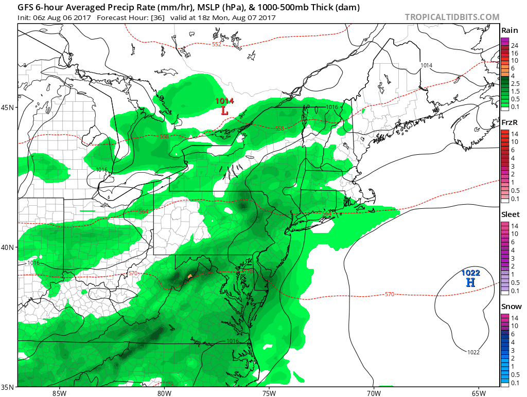
The timing of the rain looks to bring it into the area as showers late this afternoon and this evening with a period of steady and perhaps heavy downpours overnight and early Tuesday. Today's morning commute is dry, the evening is likely dry, but if you are driving around overnight watch for some heavy rain.
Tuesday morning's commute is likely wet as the rain tapers off to showers. The end of Tuesday will see some improving weather conditions and some areas, mainly north and west, will see clearing before the sun goes down Tuesday.
How Much Rain?
The big question is how much rain will each area receive? The bulk of the models I use keep the heaviest rainfall south of Boston and some limit the city to just a few hours of showers.
The period from Wednesday through much of the upcoming weekend looks nice with a lot of sunshine, no chance of rain and low humidity levels.
If you are on vacation this week, plan on indoor stuff to start the week and outdoor stuff starting Wednesday.
You can follow my updates here and on Twitter @growingwisdom.
Monday: Early sunshine, then thickening clouds. Showers later in the evening. Highs 72-76.
Monday Night: A period of showers may become a steady rain for a while. Lows 60-65.
Tuesday: Lots of clouds, some showers in the morning. Highs in the mid 70s.
Wednesday: Mostly sunny and pleasant. Highs in the mid 70s to lower 80s.
Thursday: Generally sunny and pleasant. Highs in the upper 70s to low 80s.
Friday: More sunshine, warm with a slight increase in humidity. Highs within a few degrees of 80.
This article was originally published on August 07, 2017.
