Advertisement
Forecast: Fall-Like Chill Coming, But Coolness Won't Last
ResumeAs we close out the month, we see another cool August morning.
Although it's been dry this month, the average temperature will be very close to exactly average, likely withing one- or two-tenths of a degree.
Meteorological summer — the warmest 90-day period of the year — ends today, and for the next three months the Boston area will slide toward winter. It's a sobering thought, but if you love fall, the coming weeks are yours to enjoy.
The weather over the next few days will give us a taste of fall, but the cool weather won't last. A cold front passes the area this afternoon with little fanfare. I can't 100 percent rule out a shower or storm, but I am pretty close to being able to do so.
Temperatures will be warm today, reaching around 80 inland and the 70s at the coast.
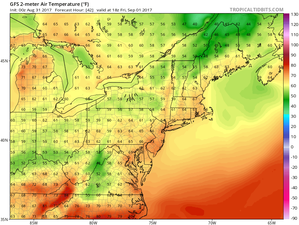
Overnight the cool air pours in from Canada. You will feel it by Friday morning with another cool start to the day. On Friday, temperatures will rise very little, remaining in the 60s and then leading us to an additional cold morning on Saturday.
Some of the favored cold spots could reach into the upper 30s for an hour or two, but it's mostly a morning in the 40s. Boston, however, will likely see highs stay around 50 degrees.
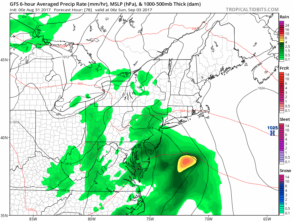
Abundant sunshine helps boost temperatures back into the lower 70s on Saturday. It's a nice day, but a bit cool for the beach. On Sunday, the remnants of Harvey move into the region. Showers come in late that night and leave late Monday morning. The wetness won't entirely clear out, but the day isn't a washout.
Monday is the best of the three day weekend with sunshine and highs around 80, the unofficial end of summer comes this weekend for many, but we still have some warmth.
You can follow my updates here and on Twitter @growingwisdom.
Thursday: Sunshine with some building mid-day clouds bringing a small risk of a shower or thunderstorm. There's a 90 percent chance you miss them. Highs 75-80.
Thursday Night: Clear and cool. Lows 48-56, warmest in Boston.
Friday: Partly to mostly sunny and cool. Highs in the mid- to upper 60s.
Saturday: Mainly sunny after a chilly start highs warm to the low to mid-70s.
Sunday: Cloudy, a period of showers for the first part of the day. Highs in the lower 70s.
Monday (Labor Day): Mainly sunny and warm. Highs near 80.
