Advertisement
Forecast: Heavy Downpours Possible Today And Tonight
It was a very muggy and warm night for early September Tuesday night with temperatures hovering around 70 much of the night.
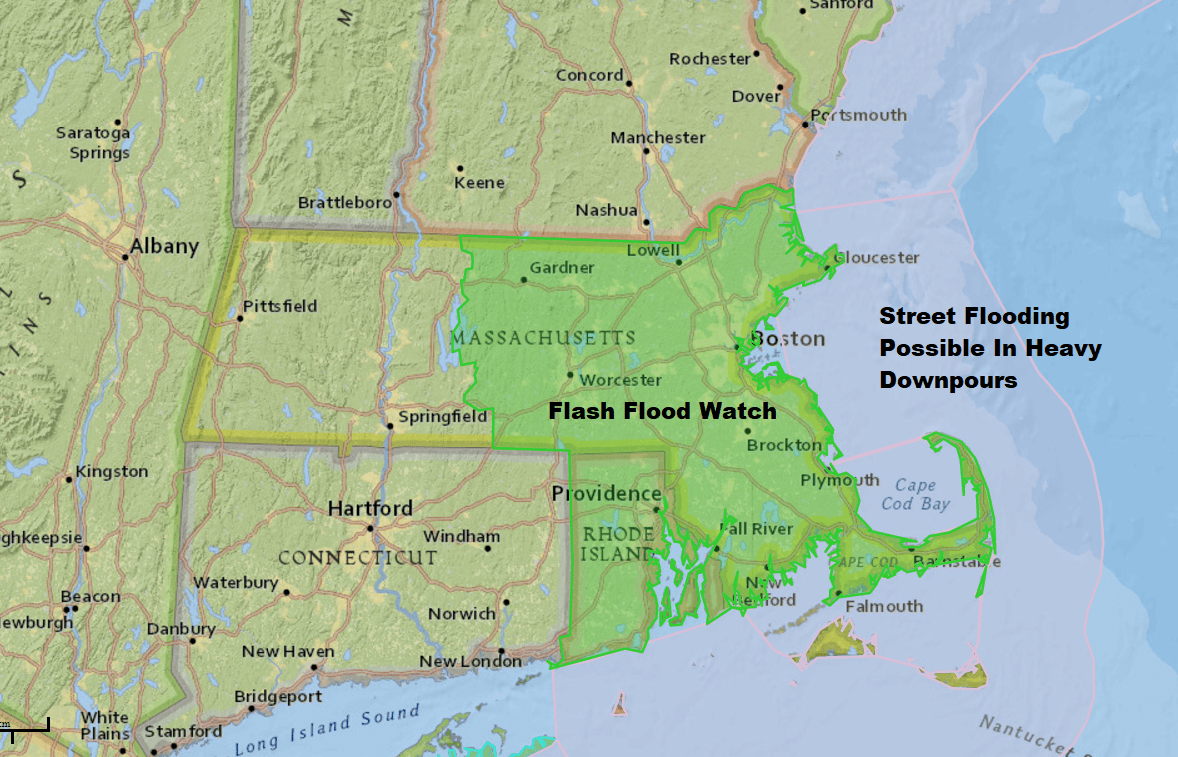
As a cold front approaches from the west, showers and thunderstorms will fire up in the humid air. This type of pattern often brings heavy downpours and thunderstorms. The National Weather Service has issued a flash flood watch for eastern Massachusetts. Any flooding will be confined to low-lying roads and wont' be an issue for streams or rivers.
Showers will continue overnight, again with some heavier rainfall at times. You may or may not hear thunder and see lightning as the front moves further east. Total rainfall will run from three-quarters of an inch to 2 inches. The range in totals is due to the inability to predict where thunderstorms will precisely occur across the area.
Once the front finally moves far enough east Thursday morning the showers will end and skies will clear. This sets up a nice period of weather lasting into the weekend with seasonably dry and cool temperatures mainly within a few degrees of 70.
Hurricane Irma
Hurricane Irma passed directly over the island of Barbuda early this morning with wind gusts at 155 miles per hour before the weather station broke. A storm surge of over 8 feet likely did a lot of damage to any beach front property. We'll need to wait until later today to understand how bad things were for that tiny island.
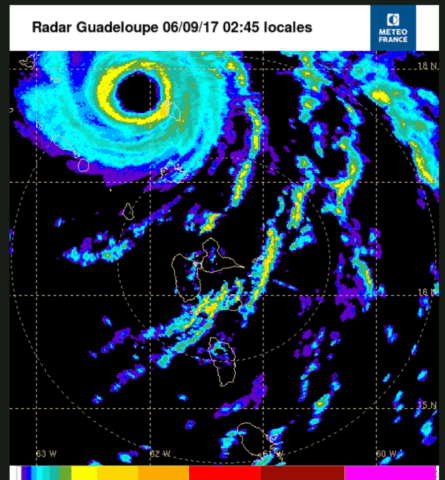
I captured a radar image, seen above, from early this morning which clearly shows the eye passing directly over the island. Notice how the other islands south of there just experience a few showers. This is why the track of the storm is so critical to understanding how the hurricane will affect Florida and the southeastern U.S.
You can follow my updates here and on Twitter @growingwisdom.
Wednesday: Muggy with scattered showers and storm. Some could contain heavy downpours, thunder and frequent lightning. Highs in the mid-70s.
Wednesday Night: Showers and thunderstorms continue, especially early. Lows 62-66.
Thursday: Showers end early, clearing developing. Sunshine takes over. Highs in the lower 70s, still muggy early and then drier.
Friday: Partly to mostly sunny and seasonably cool. Highs in the lower to mid-70s.
Saturday: Mainly sunny with highs in the lower 70s.
Sunday: Lots of sunshine. Highs 68-72.
