Advertisement
Forecast: Seasonably Chilly The Next Few Days, Winter Cold Friday
The weather Monday was quite warm, with places like Fitchburg reaching 70 degrees. A cold front swept through the area late Monday and now we dealing with an air mass from Canada, also known as continental polar (cP) air because it comes from the land and it's chilly.
This cP air will be with us for the next several days, but the dividing line between it and the milder air is still relatively close. As a result, a small area of low pressure will ride along this front to our south overnight. This will bring some clouds and the chance of rain south of the Mass. Pike.
When you get up Wednesday morning, those of you in the southeastern part of the state will likely see wet roadways, although the rain will have ended. The rest of us will already be in the sunshine, or skies will quickly clear. Temperatures both Wednesday and Thursday will be seasonable, reaching the upper 40s to mid-50s.
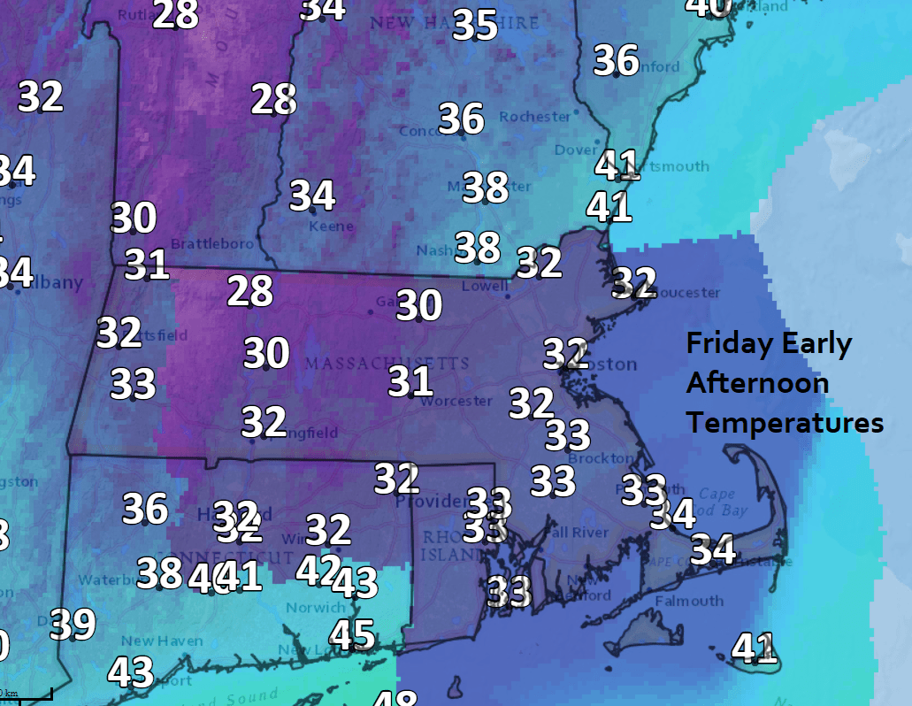
Another air mass, this one from the Arctic regions, known as continental Arctic (cA) air, will appear on Friday.
The leading edge of this air mass is marked by an arctic front which will sweep across the region before dawn on Friday. This brings the coldest air since last winter to southern New England, with high temperatures on Friday staying in the 30s to perhaps near 40 over Cape Cod.
It will feel even colder with the windchill, which will be down in the teens at times. I can't rule out a quick rain or snow shower as the front moves through Thursday night and early Friday.
The heart of the cold air moves out later Saturday with a slight moderation in temperature. By Sunday highs will reach back well into the 40s to maybe near the 50-degree mark over southeastern areas.
You can follow my updates here and on Twitter @growingwisdom.
Tuesday: Clouds increase. Highs around 50.
Tuesday Night: Chance of showers or a period of rain over Cape Cod.
Wednesday: Early clouds, then sunshine mixed with clouds and cool. Highs 49-53.
Thursday: Seasonable. Sun and clouds. Highs 50-55.
Friday: An early rain or snow shower then blustery and cold. Temperatures falling or remaining in the 30s.
Saturday: Sunshine and chilly. Highs approaching 40.
