Advertisement
Forecast: Record-Breaking Cold Possible Saturday
ResumeIt's very cold across the area this morning with Boston down in the lower 30s. As I write this, Logan Airport has not hit 32, but the suburbs are in the 20s. The ground is frozen and this is a very hard freeze — the first real one we've had all season.
Temperatures this afternoon will moderate and approach 50 degrees, a nice recovery from the morning low. There will be plenty of sunshine to start the day. Clouds will increase later, the result of an Arctic front approaching from the northwest.
High temperatures on Friday will only be in the mid-to-upper-30s and this will occur late in the morning or early in the afternoon. As the Arctic air continues to flow in from the north, temperatures will fall and I expect everyone to be below freezing by 7 or 8 in the evening.
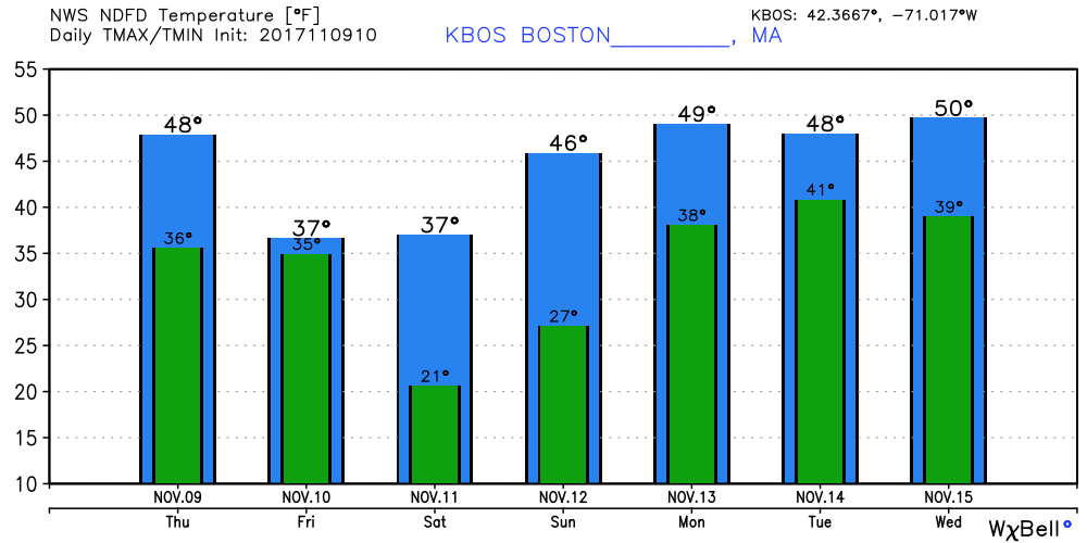
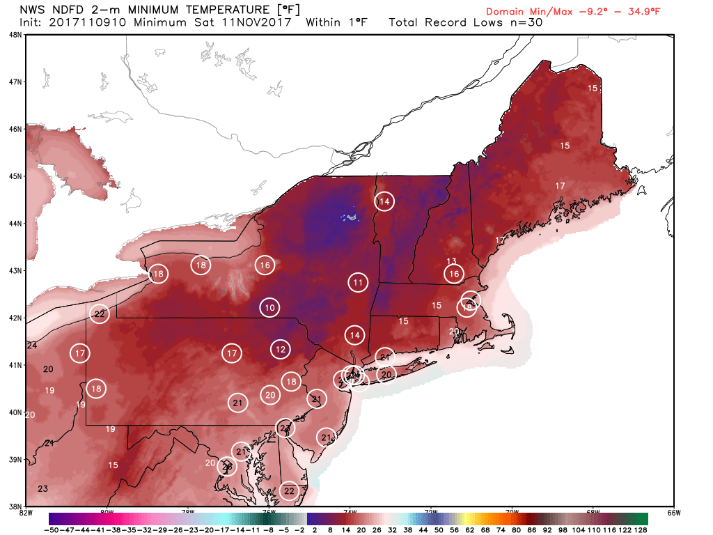
There are possible record lows on Saturday morning with many areas in the teens. The coldest temperature Boston has seen on Nov. 11 is 24 degrees, a record set back in 1901. Worcester reached a winter-like 14 degrees in 1956.
Boston has the highest chance of breaking the record. All of the stations with circles should come within a couple of degrees of their daily records on Saturday morning.
Temperatures warm near 40 by Saturday afternoon with 40s to near 50 by Sunday afternoon. There could be a sprinkle or shower Monday, but no major rain is in sight.
You can follow my updates here and on Twitter @growingwisdom.
Thursday: Seasonable. Sun early then increasing clouds. Highs 48-53.
Thursday Night: Chance of a shower, then clearing by morning. Blustery. Lows around freezing.
Friday: An early rain or snow shower then blustery and cold. Temperatures falling or remaining in the 30s.
Saturday: Sunshine and chilly. Highs in the range of 35-41.
Sunday: Sunshine and less chilly. Highs approaching 48.
Monday: Clouds, some breaks of sun and a chance of a shower. Highs around 50.
This segment aired on November 9, 2017.
