Advertisement
Forecast: Chillier Today, But Milder With Rain To End The Week
High pressure in control today will bring a nice day with comfortable winter temperatures. I expect many towns to be within a few degrees of 40 today. The sun this time of year is still weak, but it will feel pleasant in the afternoon. Winds will be light as well.
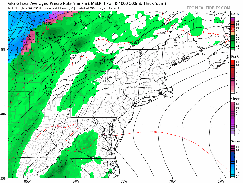
A southerly flow of air tomorrow brings even milder temperatures with highs approaching 50. A cold front will move close enough to the region to start bringing some rainfall to the area by Friday. This rain could be heavy at times.
The issue will be as the cold front moves east, it will slow down and even stall a bit. A couple of lows will likely form on the front and bring some heavy precipitation.
This upcoming rainstorm has a tropical connection and therefore the rain could be significant enough for urban and basement flooding. As the ice breaks up on some streams and smaller rivers, there could also be some issues if we see enough rainfall.
If you can clear the catch basins of snow and ice and check the sump pumps in your basement today it would be good preparation for the Friday to Saturday rain event. It's not a question of if there will be flooding, but just how much flooding and what type. Unlike the nor'easter which brought coastal flooding, this storm will bring freshwater issues.
The heaviest rain will be Friday night and Saturday morning. I do expect the rain to taper off Saturday in time for a mainly dry start to the Patriots game.
The final issue with this storm is that colder air will be working in behind it. If the cold air arrives before the precipitation ends we could see some freezing rain or sleet issues for a few hours. If you are headed to northern New England this weekend pay close attention to Friday night and Saturday forecasts as it could be quite hazardous in some places.
You can follow my updates here and on Twitter @growingwisdom.
Wednesday: Sunshine with some late afternoon clouds. Highs around 40.
Wednesday Night: Clouding up, not so cold. Lows near 30.
Thursday: Cloudy, milder. Highs 45-50.
Friday: Rain heavy at times. Highs 47-55.
Saturday: Rain, may change to freezing rain or sleet before ending, mainly north.
Sunday: Dry and colder. Highs in the lower 30s.
