Advertisement
Forecast: Because It's New England, 70s Today, Maybe Snow Tomorrow
Records were shattered yesterday in both Boston and Worcester where the temperatures reached the upper 60s to lower 70s. It's very difficult to get this warm this time of the year, with cold dense air all across Canada and the oceans so chilly.
Many places are going to repeat it again, with temperatures approaching the 70s. But it will be the end of the warm air for awhile. And yes, it might snow Thursday — up to an inch.
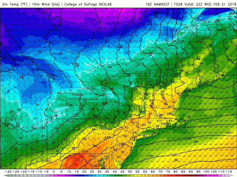
A cold front will sweep eastward overnight and a new air mass will be present over southern New England Thursday. Try to get outside and enjoy the weather today as it may very well be several weeks before we see anything this warm again. It wouldn’t be unusual to not have another 70 degree reading until April.
Unsettled Period Ahead
The weather beyond today will be influenced by this temperature boundary. Small waves of low pressure will ride along the boundary and bring periods of rain or mixed precipitation to the region through the weekend.
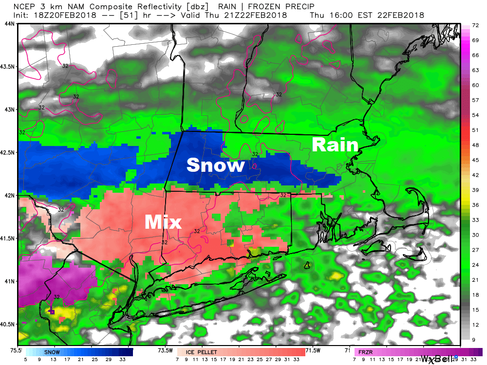
Notice on the image above there are areas of snow and mixed precipitation as well as rain. This is an image representing a computer forecast for midday Thursday. I am not expecting more than a coating to an inch of snow, mainly on grassy surfaces. The warm weather of the past two days will help to prevent any icing to occur.
There is additional wet weather this weekend mainly in the form of rain, but some mixed snow and rain or even all snow can occur further north.
You can follow my updates here and on Twitter @growingwisdom.
Wednesday: Record warmth with clouds and sunshine. Highs 65-72.
Wednesday Night: Cloudy, turning much colder. Lows in the mid to upper 30s by morning.
Thursday: A few showers and a period of mixed precipitation or all snow. Highs in the mid to upper 30s. A coating to an inch possible.
Friday: Sunshine and some clouds. Rain showers late in the day. Highs 39-45.
Saturday: Partly sunny, rain possible at night. Highs 47-54 north to south.
Sunday: Cloudy with some rain. Highs 40-45.
