Advertisement
Forecast: Snow On Tuesday Could Affect Holiday Travel
Here's a little secret into my mindset this time of the year: In our current pattern, every time there's a new model run I look at it with one eye half-closed because I'm afraid of what I might see. It's been such a stormy and cold jet stream configuration that it seems like almost anything can happen.
This week we're looking at a couple of chances of precipitation and then a high likelihood of a major storm of rain or perhaps wintry precipitation late in the weekend or early next week.
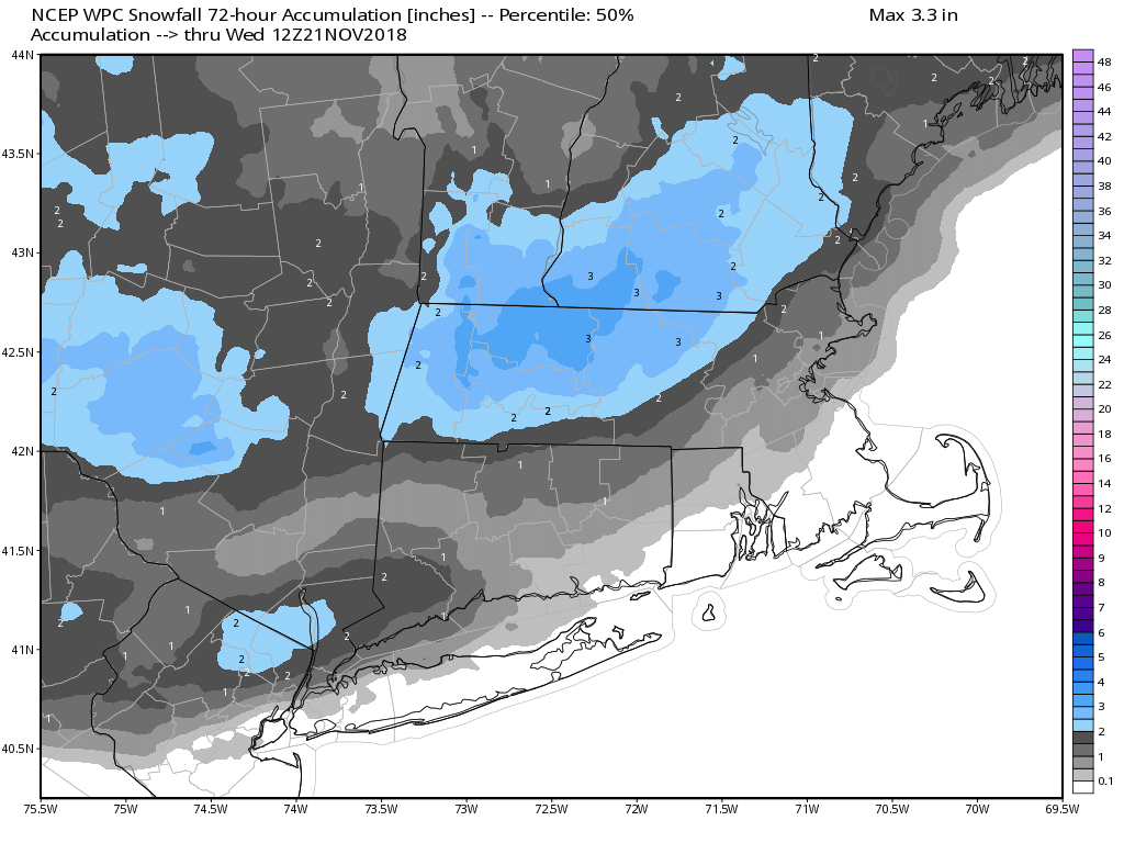
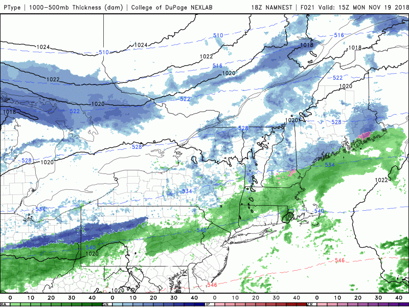
In other words, this pattern continues to be incredibly active and very wet. There's some challenges with the Tuesday storm system, as temperatures will be marginal, although getting colder. This means there's a likelihood that the snow will be most prevalent over northern areas, but the trend will be for rain to change the snow even around Boston.
This isn't going to turn into a major storm system, but again, this time of the year, on a big travel day, even a few inches of snow can hamper things quite a bit. The highest likelihood of snow accumulation is going to be after 2 or 3 in the afternoon Tuesday and through the evening commute. Tuesday can be one of the busiest travel days of the year we could see problems from this even this small amount of snow.
Wednesday is dry and cold and Thursday, Thanksgiving, is likely one of the coldest Thanksgivings ever on record. The dry weather should continue through Sunday, but we'll have to keep an eye on the development of a new storm system for late in the weekend or early next week. I have little doubt there's going to be a big storm developing in the northeastern corner of the United States but the exact track and strength and location we'll all determine just what we end up receiving.
The bottom line is things continue to look quite active and you should pay attention to latest forecast as they will often change.
You can follow my updates here and on Twitter @growingwisdom.
Monday: Clouds, some showers. Perhaps mixed with some snow well north and west. Highs 40-45.
Monday Night: A period of rain changing to snow late at night. Lows 30-38.
Tuesday: Rain and snow; the snow line will move to Boston in the afternoon. Highs in the 30s.
Wednesday: Sunshine and a few clouds. Very cold for November. Highs in the mid-30s.
Thanksgiving: Sunshine and near-record cold. Highs 21-26.
Friday: Sunshine and cold. Highs approaching freezing.
The Weekend: Dry and chilly Saturday. Perhaps some showers Sunday.
