Advertisement
Today's Weather: Some Snow Flurries, Mainly Sunny
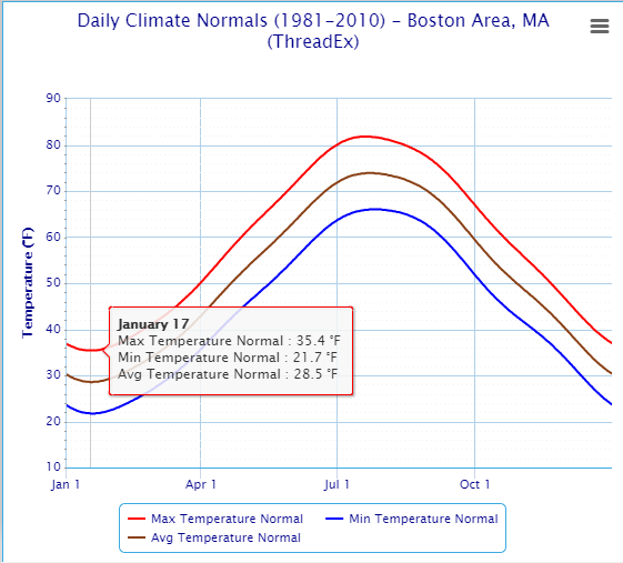
This week marks the climatological bottom of temperatures for the course of the year. This doesn't mean the coldest temperatures of any given year occur this week, but when you look at the 30-year average for all of winter, this week is the coldest week.
There are a few possible snow showers early today, but that’s not the main weather issue. The challenge this week will be less about immediate forecasting, until we get to the weekend, and more about tempering people's expectations on that weekend forecast.
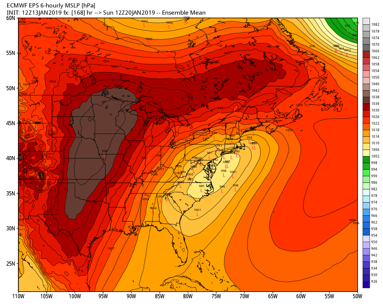
In case you haven't heard yet — and you will — there's the potential for a snowstorm around Sunday. In the social media age there’s always a lot of bad information and you'll have to rely on a trusted source (hopefully me) to sift out the noisy stuff. I saw someone post an experimental model yesterday that predicted more snow for New England than has ever occurred in recorded history — crazy stuff and not helpful.
Forecasters will have a better idea with each passing day what might occur later this weekend, but we won’t have confidence in the outcome until closer to Thursday.
Once we are about three days from the start of the storm, you can start to modify plans as needed. Remember, unless you just moved here from a warm place, you’ve likely experienced a snowstorm.
Heavy snow will slow things down, it can inconvenience us, but most of the time a storm's influence, beyond those big snow banks, is gone rather quickly. No matter what winter has in store in the coming weeks, we will all manage with a little patience. Remember, this is winter in New England. It's cold and it snows.
You can follow my updates here and on Twitter @growingwisdom.
Monday: Some coastal flurries early, otherwise mainly sunny. Highs 30-35.
Monday Night: Clear and chilly. Lows 17-24.
Tuesday: Sunshine and not as cold. Highs 35-40.
Wednesday: Sun and clouds. Highs in the lower 40s.
Thursday: High clouds and sunshine. Colder. Highs in the mid-20s to approaching 30.
Friday: Some rain or snow showers. Highs 35-41.
Saturday: Chilly and dry, snow at night possible. Highs in the 20s.
Sunday: Potential storm.
