Advertisement
Today's Weather: Chilly Day Ahead Of Quick-Hitting Storm To Come
We haven't had much winter yet this season, but brace yourself for a bit tomorrow. This isn't going to be a major storm system, though the impact to the evening commute will be quite significant.
It's all about the timing with this storm, and the exact time of the change to mixed precipitation will determine not only how much snow we see, but when the worst of the snow falls.
There aren't any notable weather patterns today or tonight and the morning commute on Tuesday will also be dry. During the late morning and afternoon Tuesday, snow will spread over southern New England. This will continue to get steadier and heavier as we head through the late afternoon.
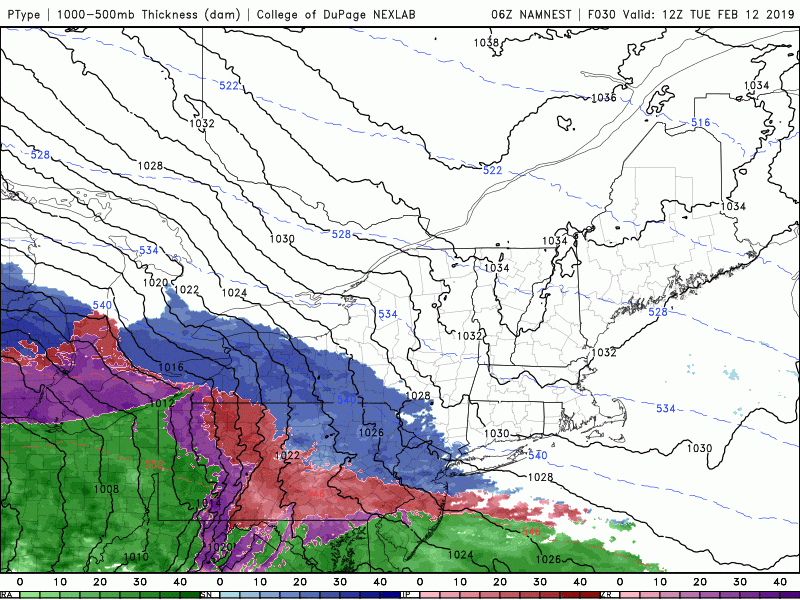
At the same time the snow is falling, warmer air will be moving northward at high levels of the atmosphere, changing the snow to sleet. This line of mixed precipitation will be steadily progressing toward the north Tuesday evening and eventually, many parts of the state will see a shift to rain before everything comes to an end.
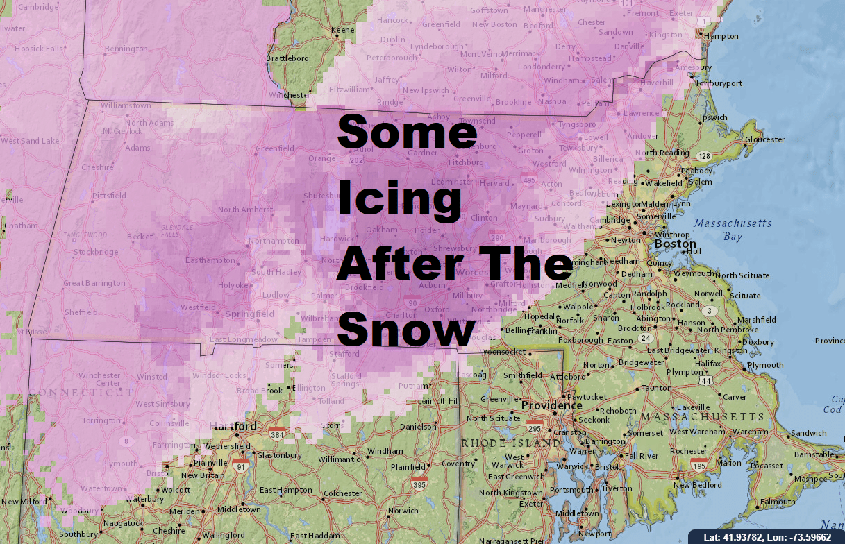
The mixing may last long enough to produce some icing north and west on top of the snow but it shouldn't be enough to cause power outages.
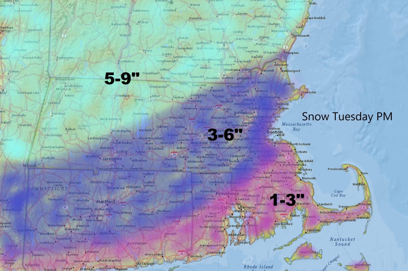
About 3 to 6 inches of snow will accumulate for a large portion of the region further north, but south of Boston and toward the Cape and Islands should only get 1 to 3 inches. The evening commute will be highly impacted. I recommend leaving before 3 p.m or after 6 p.m. if possible. Traffic will become very bad during the core of the commute tomorrow.
The precipitation comes to an end Tuesday night and with the exception of a couple of leftover showers Wednesday morning, the storm will be gone. Temperatures on Wednesday reach into the low to mid-40s, so there will definitely be melting along with a lot of sloppy driving.
The next storm at the end of the week appears to be all rain with very mild air.
You can follow my updates here and on Twitter @growingwisdom.
Monday: A blend of clouds and sunshine. Highs 32-38.
Monday night: Clouds increase late at night. Lows 15-20.
Tuesday: Dry morning, snow developing in the afternoon. Snow is heavy for the evening commute. Highs 30-35. Snow changes to a mixed bag overnight.
Wednesday: An early shower, otherwise clear. Highs 38-44.
Thursday: Sun and clouds. Highs 38-44.
Friday: Mild with rain developing. Highs 45-50
