Advertisement
Today's Weather: Storm Brings Several Inches Of Snow, Making A Mess Of Evening Commute
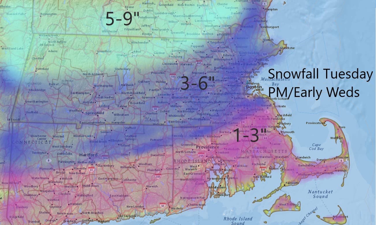
ResumeBoston hasn't seen much snow this winter, but a storm moving into the area Tuesday afternoon will bring 3 to 6 inches, just in time to clog up the evening commute.
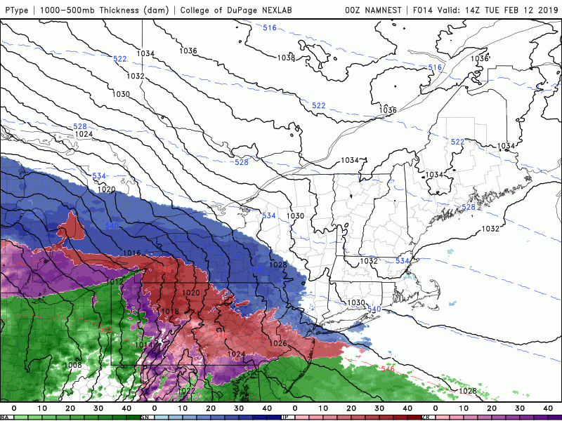
The snow will arrive this afternoon, starting around 1 to 3 p.m. and moving from west to east. It will become heavy by 4 p.m. in most areas, with rates increasing to an inch or more per hour. It shifts to mixed precipitation around 8 to 10 p.m., with a change to rain before midnight in Boston and later over northern Massachusetts. The storm will end with a few lingering showers early Wednesday.
The biggest impact from this storm will be to the evening commute. I don't have to tell you how difficult traffic is on a good day — and when you add in snow and sleet, it becomes exponentially worse. I suspect that people will leave early today once they see the snow starting to fall, and this will clog the roadways more. The worst time to be traveling is going to be between 5 and 7 p.m. and although there will still be precipitation after that time, traffic will be lighter, so it will be easier to get around.
Most areas will see between 3 and 6 inches of snow accumulation, with more as you head toward the northern part of the Merrimack Valley into Southern New Hampshire and of course into the mountains of Maine. For Cape Cod and the Islands, as well as Southeastern Massachusetts, you can expect 1 to 3 inches of snow because the change to a mixture — and eventually rain — will occur faster.
The period of sleet is likely to last a few hours, and that will accumulate up to an inch of snow north of Boston into the interior. By the way, sleet counts as snow — at least in the record books.
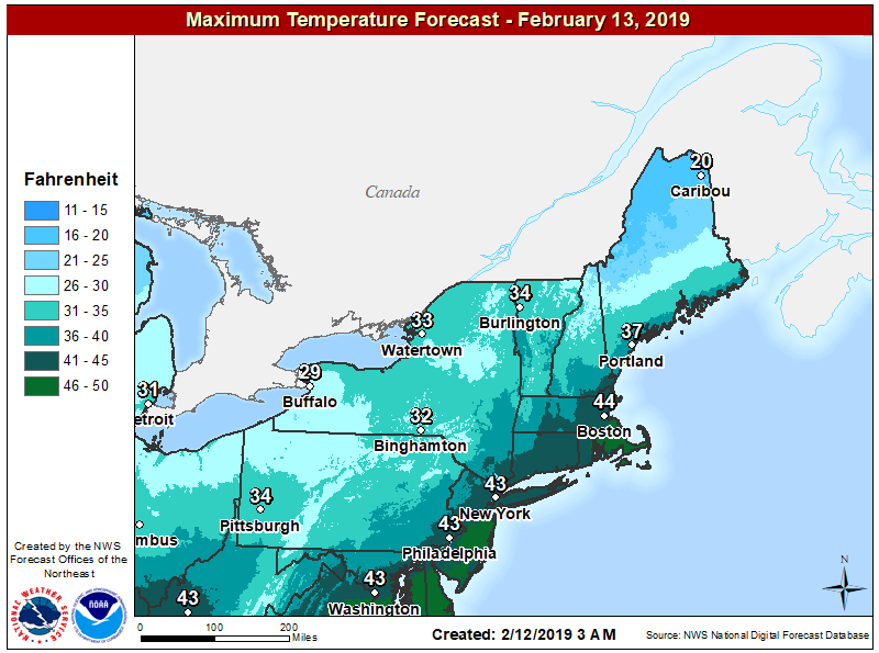
Unlike the storm in mid-January, which produced a similar precipitation pattern, the air behind this storm is going to be mild. This means we will not see a flash freeze, so you don't have to panic about cleaning up. As a matter of fact, temperatures will be in the 40s both tomorrow and Thursday. It’s even a little bit warmer on Friday, so I expect a lot of melting to occur.
A period of showers arrives with mild air on Friday before a dry and seasonable weekend ahead.
You can follow my updates here and on Twitter @growingwisdom.
Tuesday: Dry morning, snow developing in the afternoon. Snow is heavy for the evening commute. Highs 30-35. Snow changes to a mixed bag overnight.
Tuesday night: A mixed bag changes to rain and ends before morning. Lows rising above freezing.
Wednesday: An early shower, otherwise clear. Highs 38-44.
Thursday: Sun and clouds. Highs 38-44.
Friday: Mild with a few showers. Highs 45-50
Saturday: Seasonable with sunshine and clouds. Highs in the lower 40s.
This segment aired on February 12, 2019.
