Advertisement
Weekend Weather: 2 Storms In The Next 4 Days
ResumeMeteorological winter came to an end yesterday and now we're on to meteorological spring. But don't let the word spring lull you into a false sense that all the daffodils are coming up this afternoon. The first half of March is often a wintry one and so the fact we're expecting two storms over the next couple of days shouldn't surprise anybody.
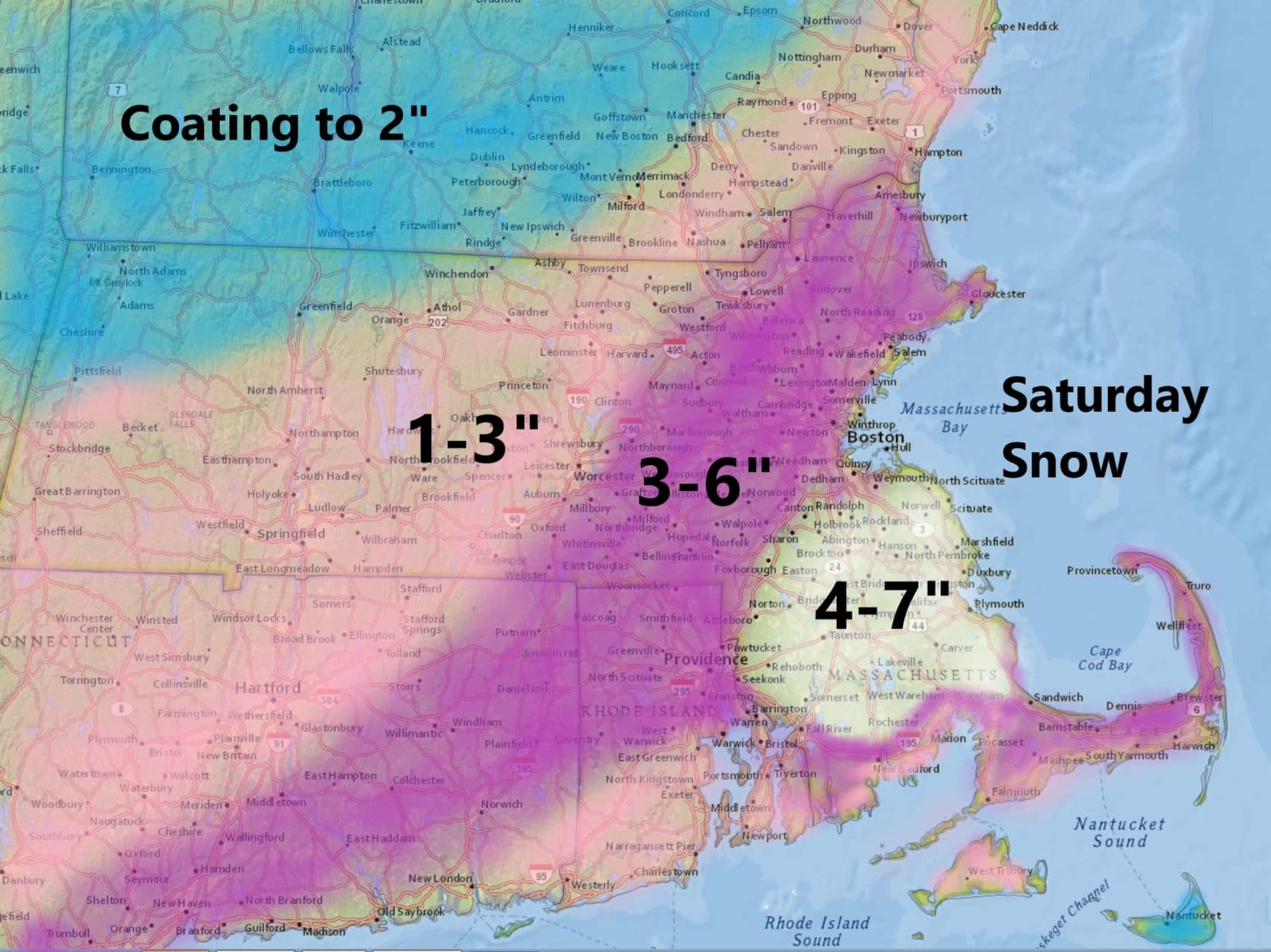
That said, it is a bit of a surprise that we're going to more snow on Saturday. Just 24 hours ago it looked as though this particular system would pass out to sea. Presently it looks like the heaviest snow will be south of Boston but even in the city up to 6 inches could fall.
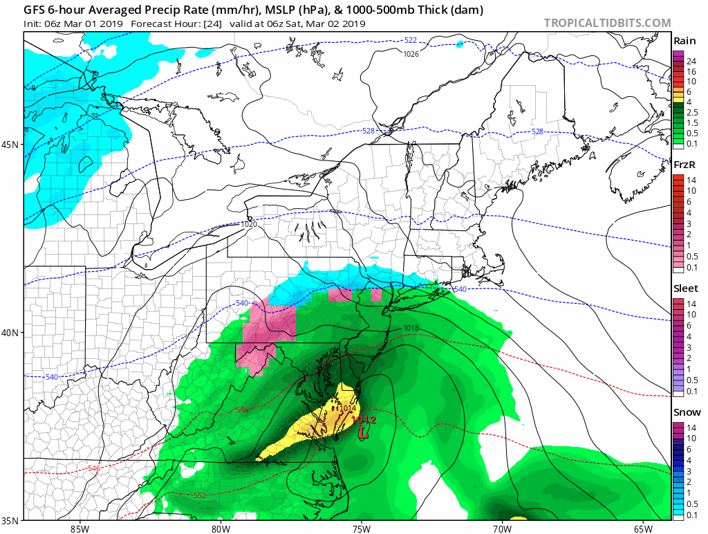
The snow arrives in the pre-dawn hours of Saturday and most accumulation is over in the early afternoon. At times the snow could be heavy. There may be lingering light snow past 3 p.m. The snow will be wetter in consistency than yesterday and will likely change to rain for a time over parts of Cape Cod. This could cause a few scattered power outages.
The projected track of the storm will keep Boston all snow. These types of fast of patterns can bring some surprises. The heaviest snow is likely to be south of Boston over the interior.
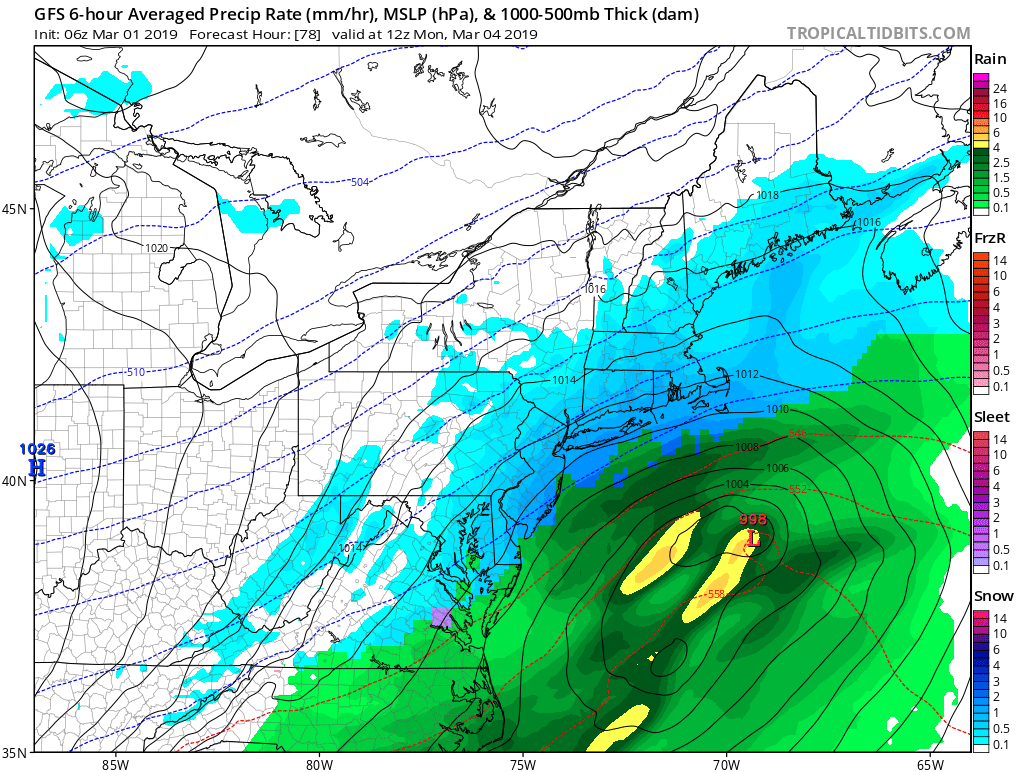
This storm is a rapid mover and by Saturday night the system is done with a brief lull for Sunday. Later Sunday and into Monday another storm system is going to move to a New England. The exact track of the system will determine how much snow we see at the beginning and how much rain we see as the transition occurs.
Behind this second system, it does turn quite cold, with temperatures averaging 10 to 15 degrees below normal for the first seven days of the month. It does look like things will moderate toward the middle part of the month. Typically we can lose quite a bit of snow cover very fast this time of the year so although we may end up with the deepest snow of the entire winter over the next few days, I expect it's going to disappear relatively quickly by the middle of the month.
You can follow my updates here and on Twitter @growingwisdom.
Friday: Sun and clouds. Highs 34-39.
Friday night: Clouding up, chilly. Lows in the upper 20s.
Saturday: Snow in the morning, tapering off in the afternoon. Snow will be a mixed bag of sleet and rain over Cape Cod, especially the south side and the Islands.
Sunday: Sunshine and clouds. Highs near 40.
Monday: More snow, perhaps changing to a mixed bag. Highs 32-38.
Tuesday: Partly sunny and cold. Highs under 30.
This segment aired on March 1, 2019.
