Advertisement
Today's Weather: A Sunny, Windy Start To The Week
The combination of a storm in eastern Canada and high pressure moving toward us from the Great Lakes will cause windy conditions in the Boston area through Tuesday. The good news is that along with the stiff westerly breeze, we’ll have lots of sunshine and temperatures about where they should be this time of year.
By Wednesday, winds will become light and temperatures will edge back into the 40s.
Although there will be plenty of bright March sunshine during the day, clouds will increase rapidly Wednesday evening, with the chance for a rain or snow shower in a few towns at night, as a warm front moves slowly northeastward.
The end of the week will feature the mildest air but with a heightened risk for showers with mostly cloudy skies.
The long-range models keep the storm track similar over the next couple weeks. This mean generally quiet weather here in southern New England with no big storms.
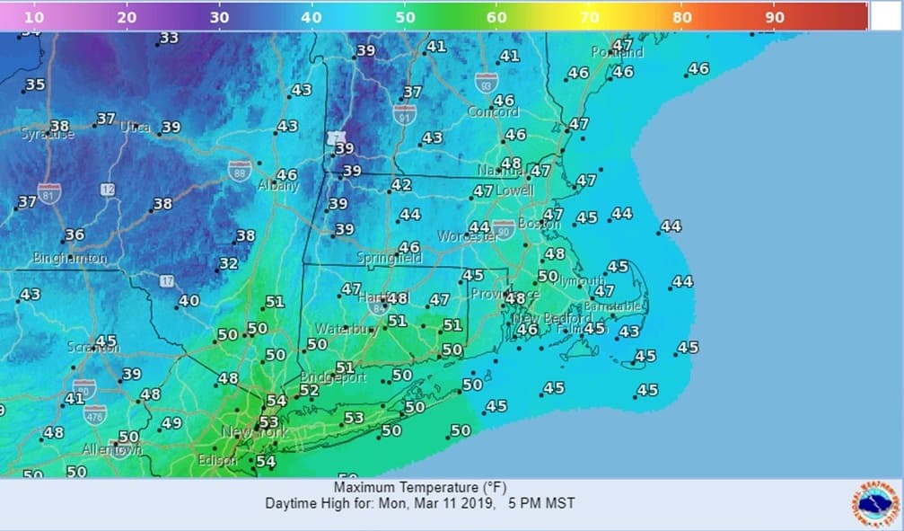
Today: Mostly sunny. Quite breezy. West winds 15 mph, with gusts up to 30 mph. High 47.
Tonight: Partly cloudy, chilly. Lows 27-32.
Tuesday: Mostly sunny, still windy and a little colder. High around 40.
Wednesday: Mostly sunny but with increasing clouds late. Chance for a snow or rain shower at night. Light winds. High 44.
Thursday: Mostly cloudy. Milder. Highs around 50.
Friday: Mostly cloudy, breezy and mild. Few showers. High 57.