Advertisement
Today's Weather: Temperatures Cool, But Sunshine Stays
An easterly flow off the ocean has brought some cloudiness into parts of coastal New England, but it looks as though much of that cloudiness will move east today, leaving us with more in the way of sunshine.
I expect temperatures to continue on the cooler side with readings in the 60s. Because of the wind off the water, 70-degree weather will not be attainable this afternoon.
It's going to turn much warmer as we head into tomorrow afternoon and especially the weekend. Before that happens, we go through one very chilly night tonight with a few spots getting into the 30s. I wouldn't be surprised if there is some frost in those normally chilly locations early Thursday morning. Because cold air sinks, the most susceptible areas for frost would be toward the New Hampshire border in little valleys and hollows.
Yes, it's still early for any frost, although it's not unusual to see a few pockets of it in the final 10 days of September.
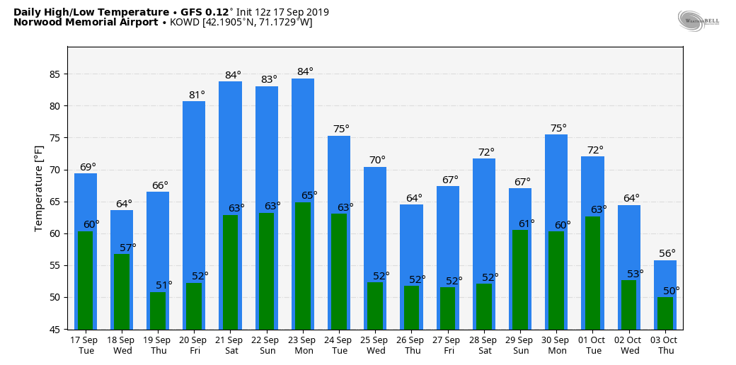
Temperatures this weekend will be at or well above 80 degrees, especially over inland areas. If you're headed to the Cape or the islands, you can expect temperatures in the 70s. This is nice beach weather and there may even be some swells from Hurricane Humberto as it passes safely out to sea.
I see no significant rain in the forecast through the rest of the month. After adequate rain in the spring and summer, the spigot has run dry for now.
You can follow my updates here and on Twitter @growingwisdom.
Wednesday: Morning clouds, some spot drizzle/fog. Sun tries to break through, especially inland. Cool. Highs in the 60s.
Wednesday night: Clear and chilly. Some isolated frost possible in northern areas susceptible to early frosts. Lows 38-48.
Thursday: Sunshine, pleasant. Highs 65-70.
Friday: Lots of sun. Highs 74-79.
Saturday: Sunshine and warm. Highs approaching 82; 70s Cape/Islands.
Sunday: More sunshine and dry. Highs within a few degrees of 85; 70s Cape/Islands.
Monday: Sunny and warm. Highs in the low to mid-80s.
Tuesday: More dry weather. Highs in the 70s.
