Advertisement
Today's Weather: Strong Coastal Storm Hits Tonight
It was a gorgeous day on Tuesday and last night, clear skies allowed temperatures to fall down into the 30s. There is scattering of frost in several spots this morning, but that's not the big weather story.
There is a term in meteorology for storms that become intense in a short period of time: "bombogenesis." In order for a storm to be classified as a meteorological bomb, it has to decrease by 24 millibars (a measurement of atmospheric pressure) in as many hours.
Tonight's storm is going to do close to that, so it's right on the edge of being one of these intense types of storms.
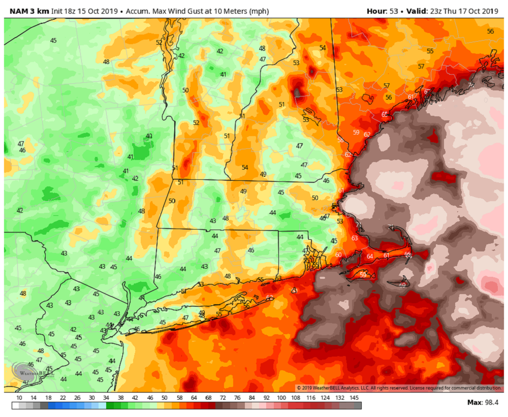
Before we get there, you'll notice clouds increasing today, but the rain will hold off until after the evening commute. As the storm’s pressure drops, air will have to rush toward it in order to fill the vacuum. This will bring about strong and gusty winds overnight and into early Thursday. Once the storm is right on top of us, winds will slacken. Then, as the storm moves north toward Maine and into Canada, the winds will resume blowing strong but from the west.
Rainfall will be about 1 to 3 inches. If you are driving around overnight or early Thursday, be prepared for some urban street flooding. There's no danger of any major river flooding because it's been so dry and the storm is moving really quickly.
Since our trees still have most of their leaves on, the strong and gusty winds will likely do some damage. This, of course, leads to power outages. You never know where these power outages are going to occur, so I always make the assumption that my power is going to go out and charge everything. Then if it doesn't, I'm no worse for wear.
Skies will clear on Friday and it's back to the sunshine, although it will still be a bit blustery. The weekend looks stunning. Sunshine will have temperatures near 60 on Saturday and into the 60s Sunday.
You can follow my updates here and on Twitter @growingwisdom.
Wednesday: Morning sunshine, then partly sunny. Some possible showers after dark. Highs 58-61.
Wednesday Night: Windswept rain overspreads the region. Lows 48-55.
Thursday: Early rain, then cloudy and blustery. Highs in the mid- to upper 50s.
Friday: Partly to mostly sunny. Highs just under 60.
Saturday: Lots of sunshine. Highs approaching 61.
Sunday: Partial sunshine and dry. Highs within a few degrees of 66.
Monday: Sunny and seasonably mild. Highs in the 60s.
