Advertisement
Today's Weather: Mild Air, Cold On The Horizon
Our November weather pattern is about to undergo a bit of a change, and that change is colder.
Although today will feature a lot of clouds and even some showers this afternoon, temperatures will be near or exceeding 60 degrees. This is likely the final time we're going to get this mild for quite a while, as much colder air arrives later this week.
Once the weather system over us today pushes east, we will enjoy a fine November day Wednesday, with plenty of sunshine and seasonably cool temperatures. It will be a good day to get outside and perhaps do some yard work.
Over the past couple of Novembers, we've ended up with colder than average conditions in the middle of the month, slowing down fall cleanup. This year, we are going to have a repeat with cold air and even the chance of snow.
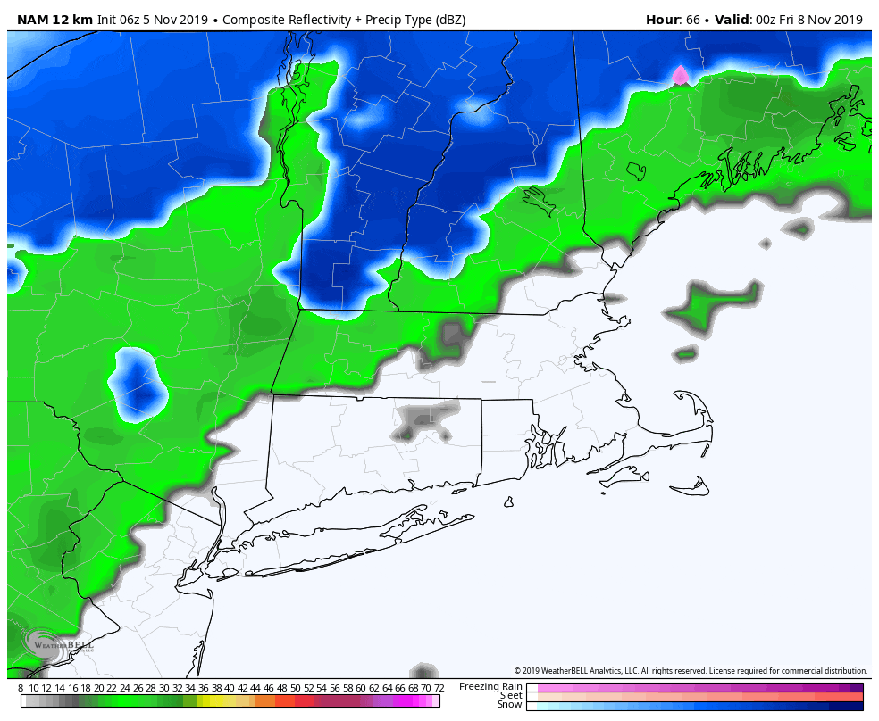
Let’s focus on the changes occurring Thursday as a frontal system approaches. We know that the air behind this front will be the coldest of the season. The question is whether any moisture from low pressure along the front combines with the cold air to give us our first snowflakes.
Some models have a stronger storm on the coast, which would mean a better chance for snow. The best chance for any significant accumulation will occur across northern New England, although some snow is possible into the higher elevations of the interior in southern areas.
The timing of this weather system would be early Friday morning, when any rain would change to snow before ending. If you are headed to the mountains or hilly terrain of the region, there could be more significant snow — so be aware if you have travel plans. To be clear, right now this is just a rain shower event for our area.
Along the coastline, it's quite difficult to get accumulating snow this time of the year, although not impossible. Water temperatures are still running in the 50s and the ground is also warm, so even if it snows it's not easy for it to stick.
Saturday is a very chilly day, with readings in the 30s. There will be some moderation in temperatures late this weekend, but overall you should prepare for early cold — not lingering warmth — the first half of this month.
You can follow my updates here and on Twitter @growingwisdom.
Tuesday: Clouds, may shower, some sun possible. Highs approaching 60.
Tuesday Night: Clearing and chilly. Lows 35-40.
Wednesday: Lots of sunshine. Highs around 50.
Thursday: Clouds, some sun, a few showers later in the day. Highs 50-55.
Friday: Rain showers may end as snow. Perhaps more significant snow in northern New England. Cold with sun and clouds in the afternoon. Highs in the 30s.
Saturday: Lots of sunshine. Highs approaching 37.
Sunday: Generally sunny. Highs within a few degrees of 47.
