Advertisement
Today's Weather: Morning Snow, Afternoon Improvement
ResumeBands of snow around the area this morning will fade away by afternoon, leaving us with dry, cold weather for the next couple of days.
There will be a 1 to 3 inch snowfall, but roads are still warm from yesterday, so there will be less sticking on the main roads. This weather event is an easy one to treat, though it's very poor timing.
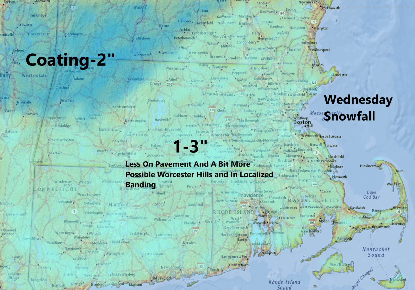
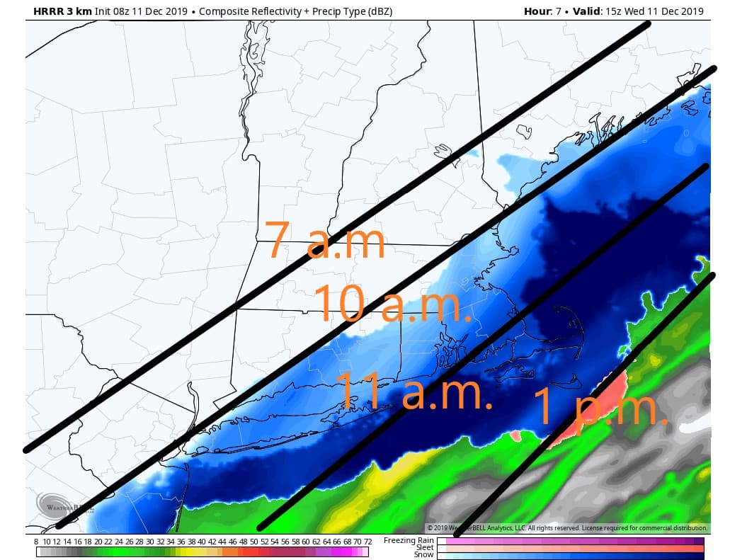
The snow should wind down between roughly 10 a.m. and 1 p.m. — last over the Cape and the Islands.
The bigger story to me is the dizzying array of temperatures we are experiencing, with readings Tuesday in the lower 60s and today's high struggling in the lower 30s.
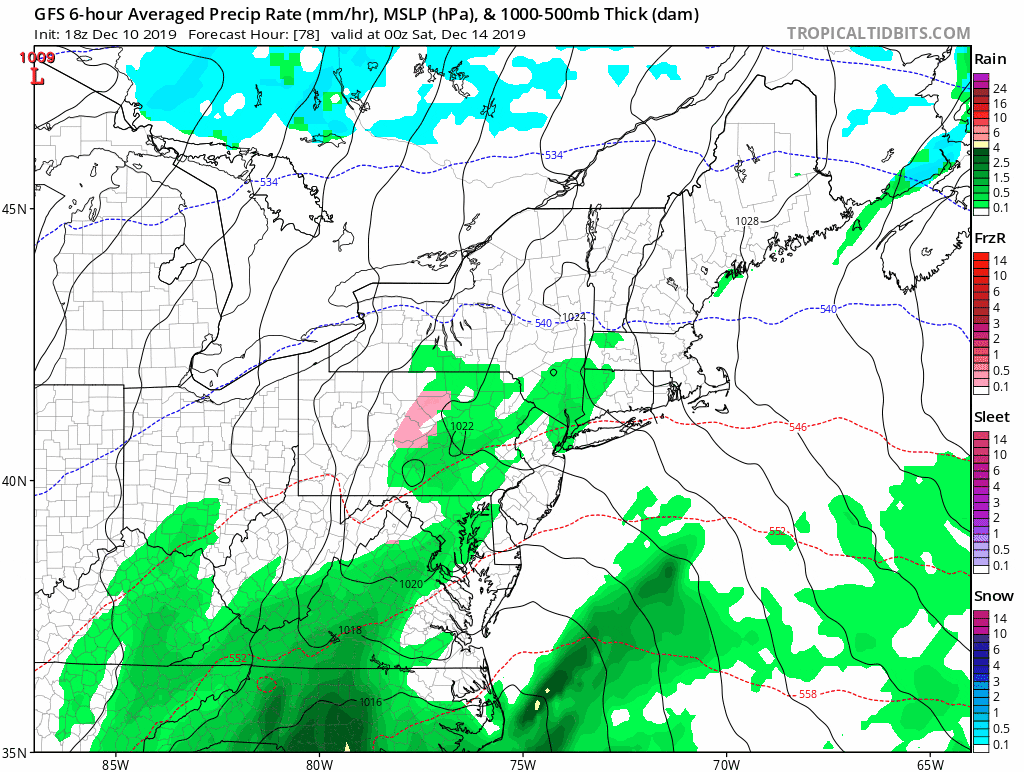
It is going to be cold for a couple of days but quite bright as well, with lots of sunshine Thursday and the first part of Friday. Clouds start to increase later Friday, setting us up for a windy rainstorm to start the weekend.
If your ground becomes covered with snow again this morning, it's likely it will disappear by Saturday evening. Once again, the storm system is going to be tracking such that milder air will flood into New England as temperatures reach back into the 50s.
Thereafter, it looks as though temperatures will be generally in the seasonable range and I don't see any prolonged Arctic air as we head into the week before Christmas.
You can follow my updates here and on Twitter @growingwisdom.
Wednesday: Snow before about 2 p.m. Highs 32-36. Roads may be quite slippery. Expect a slow morning commute.
Wednesday night: Clearing and cold. Low 20-25.
Thursday: Bright and sunny with some clouds. Below average. Highs 29-34.
Friday: Sunshine, some clouds returning. Chilly. Highs 37-42.
Saturday: Showers and windy. Highs 50-55.
Sunday: Clearing and blustery. Highs near 45.
Monday: Sunshine and chilly. Highs near 40.
This segment aired on December 11, 2019.
