Advertisement
Today's Weather: Mixed Bag Of Precipitation All Day
Resume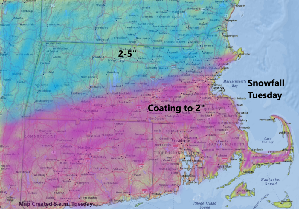
December has been an active month, with the first half offering everything from temperatures in the 60s to some significant snow. The seesaw of weather continues today with a wintry mix of precipitation.
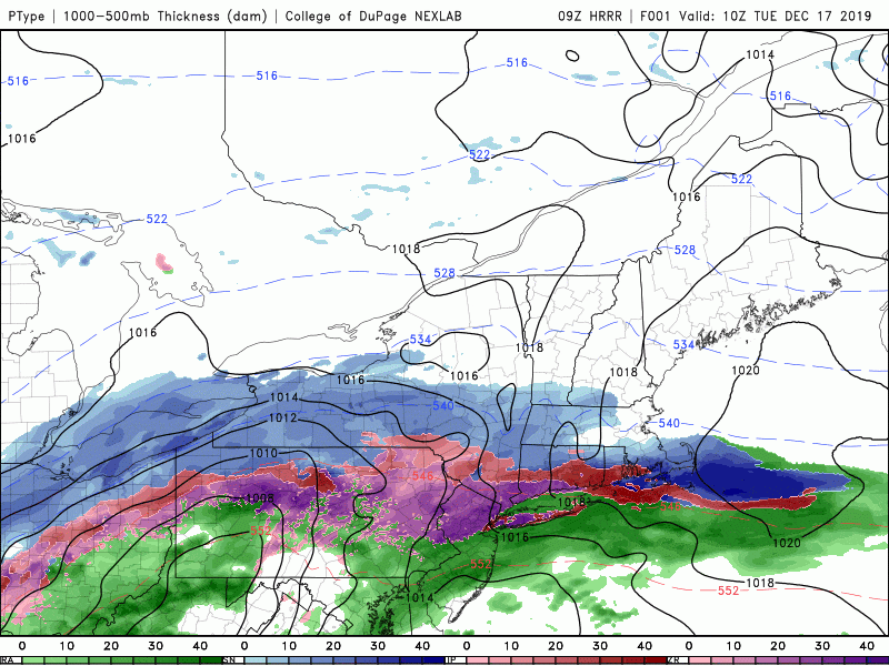
The snow the first part of the morning will transform into sleet and eventually rain, especially south of Boston. As you get into the western and northern suburbs, the precipitation is likely to remain in the frozen category. Further north across southern New Hampshire, snow is likely to be the main type of precipitation, but some sleet will mix in.
Total snowfall in Greater Boston will be in the range of a coating to a couple of inches. There will be more north of the Mass Pike, and we could see up to 5 or 6 inches in a few isolated spots as you get closer to the New Hampshire-Vermont border.
Travel will remain impacted by the weather all day, but with a well-forecast storm and plenty of crews on the roads, it should not be impossible to get around. It's winter, and life must go on in spite of the inconvenience of the weather.
Precipitation is likely to linger past the evening commute. I don't expect much in the way of accumulation, beyond some light glazing through the evening. Add in perhaps a bit of snow and sleet.
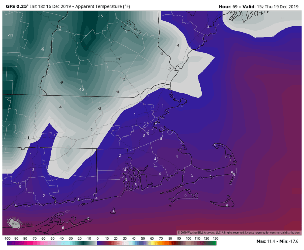
On Wednesday, an arctic front will approach the region. Temperatures will go above freezing in the middle of the day, giving us a chance to remove the last of the snow. A line of snow squalls ushers in some very cold air for this time of year on Thursday and Friday. Winds chills will hover within a few degrees of 0 on Thursday morning and temperatures will stay in the 20s both days.
I do see a moderating trend for the end of the weekend and into next week.
You can follow my updates here and on Twitter @growingwisdom.
Tuesday: A mixed bag of precipitation trending to rain at the coast. Highs in the 30s.
Tuesday night: Light mixed precipitation ending as snow, with up to a couple inches of accumulation possible. Lows 25-30.
Wednesday: A return to sunshine. Highs near 35.
Thursday: Sunshine and chilly. Highs 20-25.
Friday: Cold with sunshine. Highs in the 20s.
Saturday: Mainly sunny, highs in the upper 20s to lower 30s.
Sunday: Sunshine and clouds. Highs near 40.
Monday: Mainly sunny. Highs near 40.
This segment aired on December 17, 2019.
