Advertisement
Today's Weather: After Record-Breaking Warmth, Seasonably Cooler Temperatures Return
The incredible warmth of the weekend is now behind us, and it's back to a more seasonable but still milder than average pattern for a couple of days.
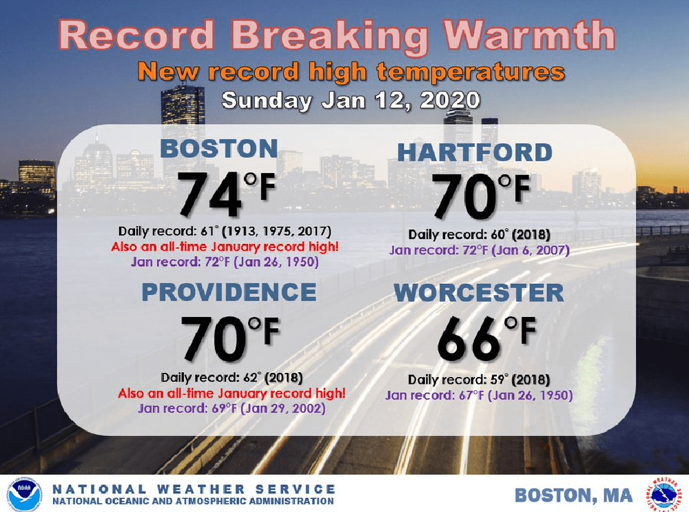
A quick note on the weekend: warmth both Saturday and Sunday reached and exceeded 70 degrees in Boston and other stations around the region. This marks the first time that Boston has seen back-to-back 70-degree weather in January, and the second time back-to-back 70 degree weather has occurred during the December through February time frame — the coldest 90 days of the year. The first was February two years ago.
While weather extremes are not about climate, the continued increase in warm records is undoubtedly a sign of our changing climate and we can expect more of this type of weather in the coming decades.
This week, there will be a weather system that brings some rain. Once this goes by, colder-than-average weather will move in for the daytime Friday — the first time we have been colder than average for quite a while.
The forecasting challenge this week is really going to come at the end of the week and over the weekend when there is a strong likelihood of some sort of a coastal system, which will bring significant precipitation amounts to New England.
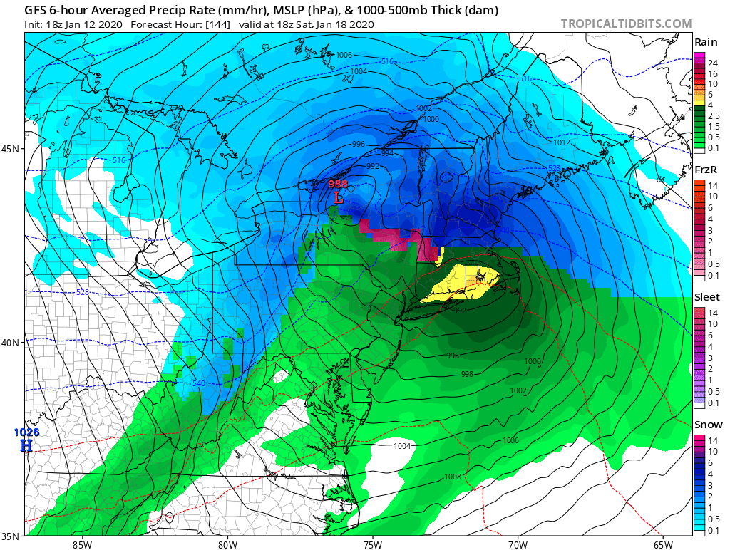
The storm is likely going to bring rain at the coast and snow inland, but obviously it is impossible to tell you where all that will occur at this point. I will say that travel disruptions are likely somewhere in New England this weekend, so if you have plans for the Martin Luther King holiday, definitely stay tuned.
You can follow my updates here and on Twitter @growingwisdom.
Monday: Clouds, maybe a few breaks. Highs in the upper 30s.
Monday night: Clouds. Lows 28-34.
Tuesday: More clouds, perhaps some late day rain showers. Highs in the lower 40s.
Wednesday: Sunshine and a few clouds. Unseasonably mild. Highs 45-50.
Thursday: Sunshine and clouds. Maybe a few rain or snow showers. Highs 38-43.
Friday: Partly sunny and cold. Highs 26-33.
Saturday: Rain or snow likely.
Sunday: Clouds and sun. May shower. Highs in the mid-40s.
