Advertisement
Weekend Weather: Storm Will Brush Southeastern Mass., Bringing Rain, Wet Snow
It appears another storm that once had the potential to bring snow to the Boston area will just miss us as it tracks east of the commonwealth this weekend. The high pressure area, which has been providing nice weather but cold temperatures, will move away.
This will allow a developing storm near the North Carolina coast to move at us later Friday night and into Saturday morning. The computer models have been consistent with keeping the center far enough off the coast to mainly affect Cape Cod and the Islands.
Clouds will begin overspreading the region Friday, with rain and wet snow reaching the south coast after midnight Friday. There could be several hours of wet snow to accumulate over the Cape, but the north edge of the precipitation will make it just to the Boston area around daybreak Saturday. At most, we can expect some flurries or light snow in the city.
Once this storm departs Sunday, we’ll have a return to some sunshine and milder conditions to start the work week. In fact, temperatures across some interior sections could approach the 50-degree mark.
Another storm will have eyes on the northeast again later next week.
Meteorologist: Dave Goldbaum for Dave Epstein
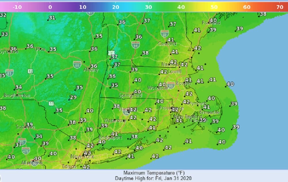
Friday: Sunshine through increasing clouds. High of 42.
Friday Night: Cloudy. Some rain developing over Cape Cod and the Islands after midnight, then changing to snow. (A few inches of wet snow are possible on the Cape.) Lows 30-35.
Saturday: Some snow showers in the Boston area around daybreak, otherwise cloudy. High near 40.
Sunday: Partly sunny. High of 42.
Monday and Tuesday: Partly sunny, breezy, milder than normal. High of 49.