Advertisement
Today's Weather: High Wind Warning Posted For Mass.
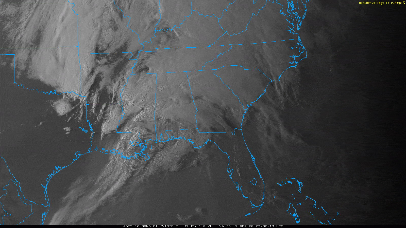
ResumeThere was some incredibly damaging weather Sunday across the southeastern portion of the United States as a major storm system developed and is now headed up toward the Great lakes. This storm brought severe weather Sunday across Mississippi and Alabama. Tornadoes were commonplace and ravaged many communities.
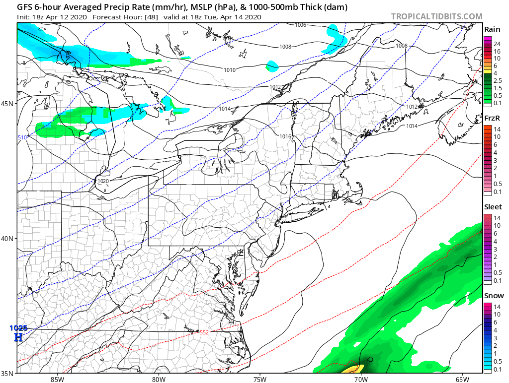
As that storm moves up into the northern part of the United States it's going to pull a very strong flow of southerly air into New England. Winds at just a couple of thousand feet above us today will be blowing at over 70 miles an hour. As we have elements of showers and thunderstorms moving through the heavy rain will pull some of that wind down, and I expect gusts of at least 60 mph in many spots. It's also not out of the question that 70 mile-an-hour gusts could occur, especially across the south-facing coastal areas of the region.
If you live on a higher elevation where you are exposed to the south you can also expect very strong winds. There's no doubt we are going to see tree damage today, and it could be significant in some places. In addition to that, there will be power outages. It's just a matter of how widespread it's going to be.
In addition to the strong winds, there's going to be heavy rain, and I expect some minor street flooding at times.
There won't be coastal flooding with this particular weather system, although there could be some minor splash over around high tide for the south coast.
The one piece of good news with this weather system is that it is moving rather quickly and will clear the area overnight, leaving us with a better day Tuesday. If you do end up having to clean up your yard from downed trees the weather will cooperate with light winds and plenty of sunshine.
Another weather system will graze the area Wednesday and Thursday. I'm not expecting much precipitation — just the chance of a couple of showers along the south coast Wednesday. All of us also could see a light shower on Thursday.
The end of the week should start to see a moderating trend, and right now the upcoming weekend does look like it will be dry.
You can follow my updates here and on Twitter @growingwisdom.
Monday: Windy with showers and thunderstorm. Winds of 25-45 miles per hour with gusts 50-70 miles per hour in thunderstorms and heavy downpours. Highs 58-64.
Monday night: Showers end, then partly cloudy to clear. Lows 40-45.
Tuesday: Sunshine with less wind. Highs 53-58.
Tuesday night: Clouding up. Lows around 40.
Wednesday: Cool for mid-April. Clouds, a shower south. Highs 45-50.
Thursday: Partly cloudy to mainly sunny. Highs 45-51.
Friday: Partly sunny. Highs nearing 50.
>Saturday: Sunshine and clouds. Highs near 52.
Sunday: Partial sunshine. Highs 53-57.
This segment aired on April 13, 2020.
