Advertisement
Weekend Weather: Tropical Storm Fay Headed To The Northeast
ResumeLate yesterday afternoon, the National Hurricane Center gave a name to the low pressure area that has now become tropical storm Fay. This is the sixth named storm of the season. The track of this will likely bring Fay west of New England or right along the New York/New England border, then up to Maine. Eventually, the system does fall apart in Canada.

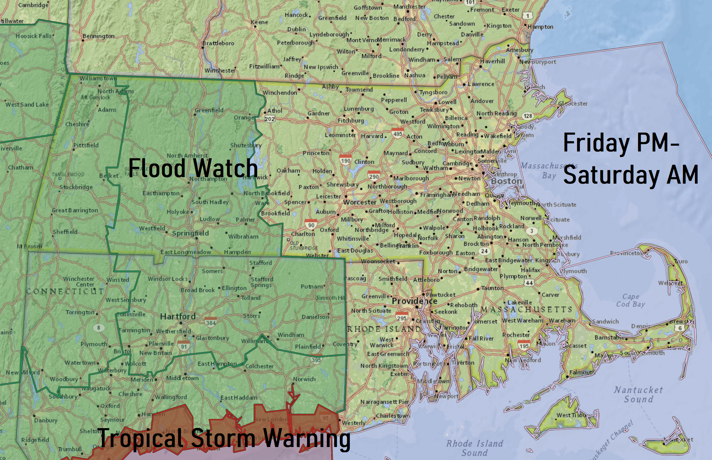
On this track, the storm will bring a swath of heavy rain, the heaviest concentration of which will be west of the storm track. There is a flood watch posted for nearly all of southern New England.
East of the storm center there will be some gusty winds and tropical downpours. There is also the chance of some severe weather. Although not widespread, there can always be some spin-up tornadoes in this environment.
We will watch bands of rain move from the south this afternoon as Fay, this tropical low pressure, rides north. In these types of situations, you can often have a glimpse or two of sunshine or moonlight, and then a torrential downpour just a few minutes later.

While I don't expect winds to be a very big factor, there could be some isolated strong gust and perhaps a power outage or two. Once we get by the first few hours after sunrise on Saturday, I think that it's just kind of a cloudy breezy day with a few scattered showers – not necessarily a great beach day but also not a washout.
Beyond that, the summer pattern continues with partly to mostly sunny days plenty of humidity and at times a scattered shower or thunderstorm, but not a lot of rain.
You can follow my updates here and on Twitter @growingwisdom.
Friday: Clouds move in, showers arrive this afternoon. Highs in the lower 80s with humidity very high.
Friday Night: Showers and maybe some thunderstorms. Tropical downpours. Outside risk of a severe weather. Warm and muggy. Lows around 70
Saturday: Tropical morning downpours, then some breaks of sun and clouds, with a period of showers. Still warm with highs near 83
Sunday: Partly cloudy. May shower. Highs around 85
Monday: Partly sunny to mostly sunny and warm. Highs 83-87
Tuesday: Partly cloudy. May shower. Highs around 84
This segment aired on July 10, 2020.
